Use the following to search across all the cemeteries listed.
Example: "Smith, Roger" (yes, use the quotes)
- 000 0-MISCELLANEOUS

Location - Various unlocated burials and cremations.
- 263 ACKLAND, WILLIAM HAYES, TOMB OF (1958)

Location - In Chapel Hill Township at 101 South Columbia St. in downtown Chapel Hill in the Ackland Art Museum.
Coordinates: 35d 54m 45.0s N; 79d 03m 18.0s W Click here for Online Maps
- 001 ALLEN'S CHAPEL CEMETERY - BLACK [ABANDONED]
Location - SW of Hillsborough in SE Cheeks Township on the east side of the loop road Moorefields Road (SR #1135), south the of entrance gate to Moorefields. Abandoned chapel and cemetery. In 2005 it appeared possible that there had been additional burials in the small cemetery.
Coordinates: 36d 02m 40.0s N; 79d 08m 40.0s W Click here for Online Maps
- 002 ALSTON GROVE CONGREGATIONAL CHURCH CEMETERY - BLACK
Location - West of Chapel Hill-Carrboro on Old Greensboro Road (Sr #1005) a short distance before the intersection with Wildcat Creek road (SR #1953). Old church and new church of frame construction; cemetery adjacent. Location is westward of Antioch Baptist Church.
Coordinates: 35d 53m 47.0s N; 79d 12m 24.0s W Click here for Online Maps
- 088 ANDREWS, ARCHIBALD FAMILY CEMETERY (CA. 1892?)
Location - In Bingham Township on the property of 6314 N. Dodson's Crossroads (SR #1102), 300 ft. from the road east of the new house just beyond an open field. Private property.
Coordinates: 35d 59m 04.5s N; 79d 09m 28.8s W Click here for Online Maps
- 090 ANDREWS, CHESLEY FAMILY CEMETERY (1897)
Location - In Bingham Township off Carlisle Road, a privately-maintained lane west off Dodson's Crossroads (SR #1102) about 1.3 miles north of its intersection with Dairyland Road (SR #1177). Where the lane ends in a 'T' turn left for about 100 yds, the cemetery is 100 ft to the left (east) in a horse pasture of the Gretna Green Ranch. It is enclosed by a wood rail fence and is exceptionally well maintained. Private property.
Coordinates: 35d 59m 12.0s N; 79d 10m 04.0s W Click here for Online Maps
- 091 ANDREWS, GEORGE FAMILY CEMETERY
Location - In Bingham Township just west of the Chapel Hill Township line, past the end of Marion's Ford Road (SR #1175) on property formerly the home of J. Bright Andrews. Go down Bright's Lane, a single lane road, 0.34 mi. and you will see a small cemetery surrounded by a rail fence adjacent to the west side of the road. Private property.
Coordinates: 35d 57m 22.7s N; 79d 08m 36.0s W Click here for Online Maps
- 092 ANDREWS, HENRY AND/OR ANDREUS, HENRY FAMILY CEMETERY
Location - West of Carrboro off Hwy 54 about 3.4 miles west of the Hwy 54-Old Fayetteville Road (SR #1937) intersection and off Sertoma Drive.
Coordinates: 35d 55m 54.2s N; 79d 09m 33.2s W Click here for Online Maps
- 093 ANDREWS, LABAN (LABORN) FAMILY CEMETERY
Location - In Bingham Township east of Dodson's Crossroads Road (SR #1102) and south of Coachway Road (SR #1214), in the vicinity of the clubhouse for "The Trails" subdivision, although the graves could not be located in 2005. Private property.
Coordinates: 35d 56m 31.0s N; 79d 10m 11.0s W Click here for Online Maps
- 094 ANDREWS, WILLIAM FAMILY CEMETERY
Location - In Chapel Hill Township NW of Chapel Hill-Carrboro, on a slight rise in a large field about 300 feet (100 yards) south of Dairyland Road (SR #1177) from a point on the road about 0.9 mi. east of Dodson's Crossroads (shortly after you cross a small branch when going east). Now destroyed; the coordinates are a reasonably accurate approximation. Located on private property.
Coordinates: 35d 58m 31.0s N; 79d 08m 53.0s W Click here for Online Maps
- 003 ANTIOCH BAPTIST CHURCH CEMETERY (ORG. 1806; MOVED 1830)
Location - West of Chapel Hill-Carrboro at the NE intersection of old Greensboro Road (SR #1005) and White Cross Road (SR #1951). A new brick church replaced the 1897 frame structure; cemetery in rear of church.
Coordinates: 35d 53m 54.0s N; 79d 11m 21.0s W Click here for Online Maps
- 120 ARMSTRONG, WILLIAM FAMILY CEMETERY (CA. 1814)
Location - In north central Little River Township near the Person County line in the woods in back of the house at 5615 Gray Road (SR #1526); 120 paces WSW (240 deg.) into the woods from the house. Approximate coordinates 36 deg, 14 min, 00 sec north; 79 deg, 00 min, 13 sec west.
Coordinates: 36d 13m 58.7s N; 79d 00m 11.4s W Click here for Online Maps
- 190 ATWATER FAMILY CEMETERY
Location - In Bingham Township south of Twin Elms Road. Twin Elms Road is a private road west off Ferguson Road (SR 1948); the cemetery sits about 200 ft south of the road and about 50 ft west of a N-S wooden fence approximately 0.9 mile west down Twin Elms Road. Private property.
Coordinates: 35d 52m 33.1s N; 79d 10m 02.8s W Click here for Online Maps
- 096 BARBEE, JOHN FAMILY CEMETERY (BEF. 1810?)
Location - In Chapel Hill Township in Duke Forest, on the north side of New Hope Creek between Whitfield Road (SR #1731) and Mt. Sinai Road (SR #1718). Adjacent to an authorized trail, but not in an authorized access area and permission to enter the cemetery must be obtained from the Office of the Duke Forest.
Coordinates: 35d 59m 13.0s N; 79d 01m 12.0s W Click here for Online Maps
- 123 BARBEE-HARGRAVES CEMETERY - BLACK (CA.1790-1915)
Location - At the end of Greenwood Road, in the loop, Chapel Hill. Owned and maintained by the Town of Chapel Hill.
Coordinates: 35d 55m 20.0s N; 79d 01m 38.0s W Click here for Online Maps
- 292 BENTON, SAMUEL (GENERAL) (1758-1810) [GRAVE OF]
Location - General Samuel Benton, who died on October 10, 1810, aged 52, was buried in the garden behind his house on lot 22 in Hillsborough after an impressive public funeral.
Coordinates: 36d 04m 31.3s N; 79d 06m 04.9s W Click here for Online Maps
- 004 BERRY'S GROVE BAPTIST CHURCH CEMETERY (ORG. 1887)
Location - In north central Little River Township just east of Hwy 157 and near the Person County line on Berry Road (SR #1523). The brick church is visible from Hwy 157; the two acre cemetery is adjacent to the church.
Coordinates: 36d 14m 06.0s N; 79d 01m 32.0s W Click here for Online Maps
- 233 BERRY, ROBERT FAMILY CEMETERY (CA. 1814)
Location - In NE Little River Township in a wooded area north of Holly Ridge Road (SR #1524). On private property with restricted access.
Coordinates: 36d 13m 42.0s N; 79d 01m 07.0s W Click here for Online Maps
- 217 BETHANY HILL MISSIONARY BAPTIST CHURCH CEMETERY - BLACK
Location - In northern Chapel Hill Township near the Hillsborough Township line at the end of Fletcher Rd./Ourso Dr. (private roads) behind a residence and also to the rear of a new lot of the "Waterstone" development which abuts the older Fletcher Rd./Ourso Dr. properties on the south and west. Access only across private property.
Coordinates: 36d 02m 32.9s N; 79d 05m 27.8s W Click here for Online Maps
- 005 BETHEL BAPTIST CHURCH CEMETERY (ORG. 1851)
Location - West of Chapel Hill-Carrboro and north of Rte 54 on Bethel-Hickory Church Road (SR #1104) at junction with Joe Mack road (SR #1103). Cemetery in rear of church.
Coordinates: 35d 56m 03.0s N; 79d 08m 23.0s W Click here for Online Maps
- 006 BETHLEHEM PRESBYTERIAN CHURCH (ORG. 1822) [SMALLER]
Location - near Oaks in West Bingham Township, on Saxaphaw Road (SR #1961), 400 ft west of Rte 54 at the Old Oaks intersection. There are two cemeteries. This is the smaller; see #221 for the larger.
Coordinates: 35d 57m 10.0s N; 79d 15m 32.0s W Click here for Online Maps
- 221 BETHLEHEM UNITED PRESBYTERIAN CHURCH (ORG. 1822) [LARGER]
Location - Near Oaks in West Bingham Township, on Saxaphaw Road (SR #1961), 400 ft west of Rte 54 at the old Oaks intersection. There are two cemeteries. This is the larger; see #006 for the smaller.
Coordinates: 35d 57m 10.0s N; 79d 15m 37.0s W Click here for Online Maps
- 007 BETHSADA BAPTIST CHURCH CEMETERY - BLACK
Location - In west central Bingham Township on Mebane-Oaks Road (SR #1007) above Oaks near the Alamance County line, near the 36 degree parallel, between Nick's Road (SR #1119) and Oak Grove Church Road (SR #1117), on the east side of the road. Cemetery in rear of brick Church.
Coordinates: 35d 59m 56.0s N; 79d 15m 49.0s W Click here for Online Maps
- 219 BIVINS FAMILY CEMETERY
Location - In Bingham Township on a farm at 4006 NC Route 54 West, 0.45 mi. SW of the highway in a field with access via a rough farm road. Private property.
Coordinates: 35d 55m 07.8s N; 79d 11m 56.9s W Click here for Online Maps
- 089 BLACKWOOD FAMILY CEMETERY (BEF. 1834)
Location - In Chapel Hill Township 0.45 mi. south of Mt. Sinai Church Road (SR #1713) and 0.55 mi. east of New Hwy 86 at the border of a pasture on a farm. Private property.
Coordinates: 35d 59m 14.6s N; 79d 03m 36.2s W Click here for Online Maps
- 098 BORLAND-STRAYHORN FAMILY CEMETERY (CA. 1832)
Location - In Southern Eno Township west of University Station Rd (SR #1712) in a trailer park with an entrance 0.3 mi. south of the Hwy US 70 Bypass. The trailer park lies between Myrtlewood Dr on the north and Wrenn Rd on the south. A modern memorial monument lies flat 250 ft. NE of the trailer park road in what is now a portion of the septic field system for the park.
Coordinates: 36d 02m 44.3s N; 79d 01m 41.9s W Click here for Online Maps
- 099 BRADSHER FAMILY CEMETERY (1868)
Location - In NE Cedar Grove Township south of the Person County line, on Hester Road (SR #1512), just southeast of 'Laws Intersection' of Hurdle Mills Road (SR #1506), Wilkerson Road (SR #1507) and Laws Store Road (SR #1103 of Person County). Cemetery sits on the north side of Hester Road about .3 mi. south from the intersection.
Coordinates: 36d 14m 16.0s N; 79d 06m 53.0s W Click here for Online Maps
- 097 BREEZE FAMILY CEMETERY
Location - In NE Cedar Grove Township west of Brown Rd (SR #1516) inside the edge of a wooded area next to a pasture. Private property.
Coordinates: 36d 12m 55.6s N; 79d 04m 41.6s W Click here for Online Maps
- 178 BROWN-PORTERFIELD FAMILY CEMETERY
Location - In Little River Township near the Person County line at the end of Beasley Road (SR #1578), which is south off of Breeze Road (SR #1515). Private property.
Coordinates: 36d 14m 01.0s N; 79d 04m 04.0s W Click here for Online Maps
- 102 BRYANT / FAUCETTE MILL GRAVES
Location - In NE Cheeks Township west of the end of Faucette Mill Rd (SR #1328), near the site of the old mill and millpond. About 300 Feet east of the old dock location at the pond. Private property.
Coordinates: 36d 06m 11.5s N; 79d 08m 29.8s W Click here for Online Maps
- 290 BURKE, GOVERNOR THOMAS (1747-1783) [GRAVE OF]
Location - In Hillsborough Township north of Governor Burke Road (SR #1556), which runs between Hwy 57 on the west and Miller Rd (SR #1555) on the east. The former site of the Governor's plantation, "Tyaquin", is 0.8 mi. east of Hwy 57. The monument site is 320 ft. north of the road. Access is through the drive to 400 Governor Burke Road.
Coordinates: 36d 06m 09.9s N; 79d 05m 17.3s W Click here for Online Maps
- 103 CABE, JOHN FAMILY CEMETERY (C.A. 1808)
Location - Located in the Eno River State Park in Eno Township, with access from the State Park parking area at the west end of Howe Street (which is off Sparger Road in Durham County). A marked hiking trail leaves the parking area on the left (west) side going north toward the river. About 10 paces to the east of the hiking trail is the entrance to another trail. This is an old road; follow this old road north 0.25 mi to the cemetery near the river.
Coordinates: 36d 02m 36.0s N; 78d 59m 23.0s W Click here for Online Maps
- 105 CABE, WILLIAM CEMETERY (1828)
Location - In Eno Township behind a residence at the end of Cabe Ford Road (SR #1570), about 200 feet SSW of the residence, just beyond the edge of the woods. Private property.
Coordinates: 36d 03m 49.9s N; 79d 00m 33.9s W Click here for Online Maps
- 258 CABE, WILLIAM SLAVE CEMETERY
Location - In Eno Township on State property at the end of Cabe Ford Road (SR #1570), in a wooded area above the Eno River and 345 ft slightly west of south from the William Cabe Cemetery (#105).
Coordinates: 36d 03m 46.5s N; 79d 00m 34.7s W Click here for Online Maps
- 253 CALDWELL-HOOPER GRAVESITE (Orig 1835, relocated abt 1858 and 1904)
Location - In Chapel Hill Township on the campus of the University of North Carolina. Known as the Caldwell Monument.
Coordinates: 35d 54m 47.0s N; 79d 03m 06.5s W Click here for Online Maps
- 220 CAMPBELL FAMILY CEMETERY
Location - In SW Cedar Grove Township on the north side of Harmony Church Road (SR #1350) .1 mi east of Back Creek, on the verge of the road across from 7812 Harmony Church Road.
Coordinates: 36d 10m 15.0s N; 79d 13m 48.0s W Click here for Online Maps
- 008 CANE CREEK BAPTIST CHURCH CEMETERY (ORG. 1789)
Location - In central Bingham Township, adjacent to the church on Orange Grove Road (SR #1006), almost opposite to the intersection with Dairyland Road (SR #1177).
Coordinates: 35d 58m 35.0s N; 79d 11m 42.0s W Click here for Online Maps
- 168 CARDEN FAMILY CEMETERY
Location - In Chapel Hill Township on the south side of Whitfield Road (SR #1731) a short distance west of Mimosa Drive (SR #1880), on a rise above the road in front of 4200 Whitfield Rd. Indicated on USGS maps. Private property.
Coordinates: 35d 58m 39.9s N; 79d 01m 34.4s W Click here for Online Maps
- 270 CAREY, JORDAN FAMILY CEMETERY (CA. 1883)
Location - In NE Cedar Grove Township east of Tapp Road (SR #1513), near the county line in a heavily wooded area. On private property with restricted access (the 43 acre tract on which it is located is PIN 9970-26-2246).
Coordinates: 36d 14m 08.8s N; 79d 05m 28.3s W Click here for Online Maps
- 009 CARR UNITED METHODIST CHURCH CEMETERY (CA. 1920)
Location - at Carr intersection (SR #1004) with Hwy 49 in northwest Orange; on northern or left hand side of Hwy 49.
Coordinates: 36d 12m 50.0s N; 79d 13m 10.0s W Click here for Online Maps
- 106 CARR, JOHN FAMILY CEMETERY (PROB. BEF. 1818)
Location - On the Orange Grove Road (SR #1006), 1-1/2 miles southwestward from Crossroads Baptist Church on the west side of the road, some 50 feet from the road in a grove of pines (visible from the road in the winter).
Coordinates: 36d 00m 57.0s N; 79d 09m 14.0s W Click here for Online Maps
- 073 CARRBORO CEMETERY [OLD] (CA. 1860)
Location - on a dirt lane beside the Southern RR tracks opposite the old RR station and south of Main Street in Carrboro. Overall view of cemetery.
Coordinates: 35d 54m 34.0s N; 79d 04m 10.0s W Click here for Online Maps
- 074 CARRBORO MUNICIPAL CEMETERY [NEW] 'WESTWOOD' (CA. 1933)
Location - At the junction of Fidelity and Davie Streets west of the Municipal Building in Carrboro.
Coordinates: 35d 54m 40.0s N; 79d 05m 02.0s W Click here for Online Maps
- 232 CATHOLIC CEMETERY [OLD GRAVEYARD]
Location - In Eno Township 100 ft. north of Jack Franklin Rd (a private single-lane road) about 0.65 mi. east of Lawrence Rd (SR #1561). Private property.
Coordinates: 36d 04m 53.9s N; 79d 02m 55.2s W Click here for Online Maps
- 010 CEDAR GROVE UNITED METHODIST CHURCH CEMETERY (ORG. 1832)
Location - In Cedar Grove in NW Orange County on the west side of the Efland-Cedar Grove Road (SR #1357) just north of the intersection of SR #1004, SR #1352, and SR #1357. The church and cemetery are on the west side of SR #1357.
Coordinates: 36d 10m 09.0s N; 79d 10m 05.0s W Click here for Online Maps
- 026 CENTRAL BAPTIST CHURCH CEMETERY (formerly Free Grace Baptist Tabernacle) (CA. 1965)
Location - In SW Cheeks Township at the NE intersection of Bushy Cook Road (SR #1137) and Buckhorn Road (SR #1114) between Buckhorn and Cheeks Crossroads. Cemetery in rear of church.
Coordinates: 36d 03m 08.0s N; 79d 13m 15.0s W Click here for Online Maps
- 076 CHAPEL HILL CEMETERY [OLD] - BLACK SECTIONS A-B (CA. 1798)
Location - On north side of Raleigh Rd opposite Carmichael Auditorium, UNC campus. Owned and maintained by the Town of Chapel Hill.
Coordinates: 35d 54m 39.4s N; 79d 02m 42.4s W Click here for Online Maps
- 229 CHAPEL HILL CEMETERY [OLD] - WHITE SECTIONS I-IV (CA. 1798)
Location - In Chapel Hill on the north side of Raleigh Road across from Carmichael Auditorium, UNC campus.
Coordinates: 35d 54m 39.7s N; 79d 02m 36.7s W Click here for Online Maps
- 077 CHAPEL HILL MEMORIAL CEMETERY [NEW] (CA. 1949)
Location - On Rte 15-501 north of Eastgate Shopping Center on the east side of the road.
Coordinates: 35d 56m 33.0s N; 79d 00m 51.0s W Click here for Online Maps
- 085 CHAPEL HILL MEMORIAL GARDENS (1953)
Location - On new Hwy 86 not far from Blackwood Station.
Coordinates: 35d 59m 22.0s N; 79d 04m 15.0s W Click here for Online Maps
- 107 CHEEK AND WHITAKER FAMILY CEMETERY (CA. 1836 OR EARLIER)
Location - In Chapel Hill Township about 750 ft. WNW of the end of that portion of Hatch Road (SR #1944) which is north of Hwy 54, west of Carrboro about 1.3 miles from the Hwy 54-Old Fayetteville Road (SR #1937) intersection. Private property.
Coordinates: 35d 55m 50.0s N; 79d 07m 18.0s W Click here for Online Maps
- 108 CHEEK, WILLIAM CEMETERY (CA. 1881 OR BEFORE)
Location - In NW Bingham Township north of Oak Grove Baptist Church. Located on the eastern side of a dirt road extension of Nick's Road (SR #1119) [possibly a private road, and apparently where it crosses Oak Grove Church Road (SR #1117) - 1996 comment]. Road extends from paving up hill and the Cheek Cemetery is located 2 miles from the paving of Oak Grove Church Road (SR #1117), well behind the third trailer across a ravine. The cemetery is enclosed by a chain link fence.
- 012 CHESTNUT RIDGE UNITED METHODIST CHURCH CEMETERY (CA. 1839)
Location - On SR #1125 south of Efland near the intersection with SR #1124. New brick church is on west side of SR #1125; the cemetery is on the east side of the road.
Coordinates: 36d 02m 11.0s N; 79d 11m 12.0s W Click here for Online Maps
- 140 CHRISTOPHER FAMILY CEMETERY
Location - In Cedar Grove Township on the north side of Rte 49, 0.25 miles NE of the intersection with Lynch Store Road (SR #1364). It is a short distance NE of the Mt. Adar Church.
Coordinates: 36d 12m 24.5s N; 79d 13m 43.2s W Click here for Online Maps
- 250 CLARK FAMILY CEMETERY - BLACK
Location - In NW Chapel Hill Township at 200 Davis Road, adjacent to the east gate entrance to the grounds of the Hillsborough United Church of Christ.
Coordinates: 36d 01m 44.7s N; 79d 06m 04.4s W Click here for Online Maps
- 011 CLOVER GARDEN METHODIST CHURCH CEMETERY (CA. 1836)
Location - West of Chapel Hill-Carrboro on SW Bingham Township on the east side of Orange Chapel-Clover Garden Road (SR #1956) about 1200 ft south of its intersection with Morrow Mill Road (SR #1958). Cemetery is adjacent to the church.
Coordinates: 35d 55m 04.0s N; 79d 14m 15.0s W Click here for Online Maps
- 110 COLE (COLE-WOMBLE) FAMILY CEMETERY (CA. 1889)
Location - In Chapel Hill Township on Smith Level Road (SR #1919) at the intersection with Damascus Church Road (SR #1940) on a slight elevation above Smith Level Road.
Coordinates: 35d 53m 01.0s N; 79d 04m 57.0s W Click here for Online Maps
- 225 COLEMAN FAMILY CEMETERY
Location - In Cedar Grove Township east of the NE corner of Wood Loop Rd (SR #1549) on a farm. Private property.
Coordinates: 36d 09m 57.7s N; 79d 04m 28.4s W Click here for Online Maps
- 111 COMPTON FAMILY CEMETERY (CA. 1819 OR EARLIER)
Location - In NW Cedar Grove Twp on a farm at 6703 Corbett Ridge Road (SR #1004), 1.7 mi north of Carr intersection (Hwy 49). In a clump of trees on a rise in the pasture southeast of a large white house which is just off the road. Private property.
Coordinates: 36d 13m 49.0s N; 79d 14m 04.0s W Click here for Online Maps
- 013 COOL SPRINGS BAPTIST CHURCH CEMETERY (CA. 1870S) [ABANDONED]
Location - In Cheeks Township in Efland on the south side of Rte US 70 behind a small brick church building on the SW corner of Gaines Chapel Road (SR #1316). In the middle of a multifamily-building housing development.
Coordinates: 36d 04m 49.0s N; 79d 11m 00.0s W Click here for Online Maps
- 236 CORBETT RIDGE ROAD CEMETERY [UNIDENTIFIED]
Location - Eastern side of Corbett Ridge Road. 3.9 mi. from intersection ... [?]
- 113 COUCH FAMILY CEMETERY (1888)
Location - In NE Chapel Hill Township at 4900 Cornwallis Road (SR #1716), 0.8 mi west of Kerley Road (SR #1717). The historic farmhouse at this location was restored in 2005.
Coordinates: 36d 00m 55.0s N; 79d 00m 10.0s W Click here for Online Maps
- 289 COUCH, THOMAS AND WILLIAM FAMILY CEMETERY
Location - In Chapel Hill Township east of Friends School Rd (SR #1719) in Duke Forest. In an area bounded by private property and not on an authorized trail or in an authorized access area; permission to visit must be obtained from the Office of the Duke Forest.
Coordinates: 36d 00m 16.2s N; 79d 00m 57.9s W Click here for Online Maps
- 114 COUCH-PICKETT FAMILY CEMETERY (CA.1844)
Location - In NE Chapel Hill Township where the 'Old Pickett Place' previously stood, on the west side of Kerley Road (SR #1717) at 4500 Kerley Road, a short distance below the intersection with SR #1716 (Cornwallis Road). A lane leads to a modern house and a few outbuildings. The cemetery is 525 ft north in an oval shaped clump of trees on a rise beyond the pond. Private property.
Coordinates: 36d 00m 22.0s N; 78d 59m 39.0s W Click here for Online Maps
- 115 COUCH-RIGSBEE FAMILY CEMETERY (CA.1890 OR EARLIER)
Location - In NE Chapel Hill Township 400 ft south of Cornwallis Rd (SR #1716) and 0.4 mi west of Kerley Rd (SR #1717). It is 140 ft south of the large pond. Private property.
Coordinates: 36d 00m 41.4s N; 78d 59m 51.6s W Click here for Online Maps
- 083 COUNTY HOME (OLD) BURIAL GROUND (ABT 1823)
Location - At the NW corner of the Efland-Cedar Grove Road (SR #1004) intersection with Lebanon Road (SR #1306), About 1 1/2 miles north of Efland.
Coordinates: 36d 06m 15.0s N; 79d 10m 42.0s W Click here for Online Maps
- 248 CRABTREE, JOSEPH FAMILY CEMETERY
Location - Just behind the old and abandoned Five Forks Baptist Church in northern Cedar Grove Township on the north side of and adjacent to Hurdle Mills Rd (SR #1506), 0.2 mi east of Wheelers Church Rd (SR #1505). On private property.
Coordinates: 36d 14m 13.5s N; 79d 07m 41.3s W Click here for Online Maps
- 116 CRAIG FAMILY CEMETERY (CA. 1918?)
Location - Located in Chapel Hill Township south of Carrboro between Lots 13 and 14 in Dogwood Acres subdivision, across from #29 South Circle Drive.
Coordinates: 35d 52m 31.0s N; 79d 04m 37.0s W Click here for Online Maps
- 237 CRAIGE, ISAAC FAMILY CEMETERY (Abt 1830)
Location - In Chapel Hill Township off of a private road extension of Homer-Ruffin Road (SR #2217), south of New Hope Church Road (SR #1723) just west its intersection with I-40. Private property.
Coordinates: 36d 00m 11.0s N; 79d 05m 07.0s W Click here for Online Maps
- 082 CRESMONT MEMORIAL PARK (CA. 1907)
Location - In Hillsborough township at the northeast corner of the intersection of Hwy US 70 Bypass and Hwy 86 at the northern boundary of Hillsborough. The cemetery is also referred to as "Crestmont." (Note: the cemetery was incorrectly labeled "Mars Hill Cemetery" on a USGS map.)
Coordinates: 36d 05m 13.0s N; 79d 06m 06.0s W Click here for Online Maps
- 014 CROSS ROADS BAPTIST CHURCH CEMETERY (CA. 1867)
Location - SW of Hillsborough in NW Chapel Hill Township on Crossroads Church Cemetery Road (SR #1131), which intersects the Orange Grove Road (SR #1006) near the church. The cemetery is about 1/2 mile east of the church.
Coordinates: 36d 01m 47.0s N; 79d 07m 47.0s W Click here for Online Maps
- 118 CROSSETT FAMILY CEMETERY
Location - In northern central Cedar Grove Township near the Orange, Person and Caswell County line intersection. Southeast of the intersection of Hensley Road (SR #1500) and Bama Road (SR #1503), on a farm across Bama Road from 4200 Bama Road. Private Property.
Coordinates: 36d 14m 19.0s N; 79d 09m 14.0s W Click here for Online Maps
- 015 DAMASCUS UNITED CONGREGATIONAL CHRISTIAN CHURCH (1797)
Location - On SR #1940, Damascus Church Road, a short distance southward from its intersection with SR #1942, Jones Ferry Road. On the east side of the road. The cemetery adjoins the Church.
Coordinates: 35d 52m 43.0s N; 79d 07m 27.0s W Click here for Online Maps
- 119 DANIEL, JAMES B. FAMILY CEMETERY
Location - In north central Cedar Grove Township, on the east side of McDade Store Road (SR #1354) south of the intersection with Hwy 86 North. Behind the site of the former home of the late Jeff Lee Roberts at what is now 124 McDade Store Road. The cemetery is 450 ft SE of the road in a work area. Private property.
Coordinates: 36d 12m 14.0s N; 79d 09m 28.0s W Click here for Online Maps
- 122 DAVIS, CHARLES FAMILY CEMETERY (CA. 1890)
Location - On the west side of Old Fayetteville Road (SR #1937) north of the intersection with Jones Ferry Road (SR #1942) and .95 miles south of the intersection with Hwy 54. The cemetery borders the road.
Coordinates: 35d 54m 26.1s N; 79d 05m 33.1s W Click here for Online Maps
- 121 DAVIS, JULIUS FAMILY CEMETERY
Location - In Cedar Grove Township off Highland Farm Road (SR #1332) about 1/2 mile south of the Cedar Grove Road (SR #1004) intersection]. At what is now Twin Oaks Ranch, 4314 Highland Farm Road, but in the 1970s was "at Jim Minnis'; near Major Harvey Knowles new homesite." Private property.
Coordinates: 36d 08m 24.0s N; 79d 09m 39.0s W Click here for Online Maps
- 231 DAYE FAMILY CEMETERY
Location - In Hillsborough Township NW of Durham off Faucette Mill Rd (SR #1328) just to the SE of 619 Faucette Mill Rd, in a wooded lot on the north side of the road. Private property.
Coordinates: 36d 05m 36.6s N; 79d 07m 07.1s W Click here for Online Maps
- 235 DURHAM, ARCHIBALD FAMILY CEMETERY (CA. 1813?)
Location - In Bingham Township off Oak Forest Rd, which runs south from Tripp Rd; both private roads. On the west side of Terrell's Creek next to the clearing for a new house. Private property.
Coordinates: 35d 53m 10.1s N; 79d 11m 10.7s W Click here for Online Maps
- 124 DURHAM, THOMAS M. FAMILY CEMETERY (CA. 1845)
Location - In SW Bingham Township exactly 0.1 mile east of Collins Creek Bridge on Old Greensboro Rd (SR #1005, formerly Antioch Church Rd) and 185 ft north of the highway in a wooded area.
Coordinates: 35d 53m 50.7s N; 79d 13m 55.2s W Click here for Online Maps
- 017 EBENEZER BAPTIST CHURCH CEMETERY (1896)
Location - In east central Orange County on Pleasant Green Road (SR #1567) at the northwest corner of its intersection with Ebenezer Church Road (SR #1572). The cemetery is north of the church.
Coordinates: 36d 06m 00.0s N; 78d 59m 25.0s W Click here for Online Maps
- 126 EDWARDS-CABE FAMILY CEMETERY
Location - In Bingham Township on a farm at 4006 NC Route 54 West, 0.52 mi. SW of the highway in a field. Private property.
Coordinates: 35d 55m 22.9s N; 79d 12m 26.9s W Click here for Online Maps
- 016 EFLAND PRESBYTERIAN CHURCH CEMETERY (1909)
Location - at the NW intersection of Hwy US 70 and SR #1004 in Efland. Opposite the church.
Coordinates: 36d 04m 53.0s N; 79d 10m 27.0s W Click here for Online Maps
- 018 EFLAND UNITED METHODIST CHURCH CEMETERY (NEW: 1975)
Location - North of Efland, at the intersection of SR #1324, SR #1306, and SR #1338, 1 1/2 miles north of Hwy US 70 on SR #1324. at the NE corner of the intersection.
Coordinates: 36d 06m 03.0s N; 79d 09m 55.0s W Click here for Online Maps
- 019 EFLAND UNITED METHODIST CHURCH CEMETERY (OLD: CA. 1902)
Location - In Efland at the SE intersection of Hwy US 70 and SR #1324. The cemetery is in two sections and adjoins the church on the east.
Coordinates: 36d 04m 51.0s N; 79d 10m 05.0s W Click here for Online Maps
- 021 ENO PRESBYTERIAN CHURCH CEMETERY (NEW: 1898)
Location - In Cedar Grove, northwest Orange County, a short distance north on the Efland-Cedar Grove Road (SR #1357) from the intersection of SR #1004, SR #1352, and SR #1357 in Cedar Grove, on the east side of the road. Picture of church sign. Panoramic view of cemetery.
Coordinates: 36d 10m 17.0s N; 79d 09m 58.0s W Click here for Online Maps
- 020 ENO PRESBYTERIAN CHURCH CEMETERY (ORG. 1755) 'OLD ENO'
Location - In north central Orange County, .3 miles west from Rte 86 north, via Carr Store Road (SR #1352) to Eno Cemetery Road (SR #1383), south on that road 1.1 miles to the cemetery. On the shore of Lake Orange, formerly the east fork of the Eno River, where the original church was built. Note the state historical marker at the intersection of Carr Store Road and Eno Cemetery Road.
Coordinates: 36d 09m 27.0s N; 79d 08m 41.0s W Click here for Online Maps
- 022 FAIRFIELD PRESBYTERIAN CHURCH CEMETERY (1834)
Location - On the Efland to Cedar Grove Road (SR #1004) at its SE intersection with Halls Mill Road (SR #1336) in NE Cheeks Township.
Coordinates: 36d 07m 24.0s N; 79d 10m 27.0s W Click here for Online Maps
- 023 FIVE FORKS BAPTIST CHURCH CEMETERY (CA. 1957)
Location - In Central Cedar Grove Township, on new Hwy 86 North, north of Cedar Grove School at the junction of Hwy 86 with Hawkins Road (SR #1508). Brick church on the left hand side of the road with woods and cemetery adjacent.
Coordinates: 36d 12m 12.0s N; 79d 09m 00.0s W Click here for Online Maps
- 024 FLAT ROCK A.M.E. CHURCH CEMETERY (NEW) - BLACK (CA. 1920'S)
Location - Northeast of Hillsborough on the New Sharon Church Road (SR #1538) a short distance from the intersection with St. Mary's Road (SR #1002). Adjacent to the new (1952) A. M. E. Church. The old cemetery lies diagonally across the road within the woods.
Coordinates: 36d 06m 25.0s N; 79d 03m 12.0s W Click here for Online Maps
- 025 FLAT ROCK A.M.E. CHURCH CEMETERY (OLD) - BLACK
Location - In SW Eno Township east of Hillsborough, west of New Sharon Church Road (SR #1538) a short distance from its intersection with St. Mary's Road (SR #1002). In a wooded area just west of Little Creek, a tributary of the Eno River. The old Flat Rock School once stood near the cemetery. Private property.
Coordinates: 36d 05m 47.3s N; 79d 03m 29.4s W Click here for Online Maps
- 129 FREELAND, JOHN FAMILY CEMETERY (CA. 1827)
Location - In Chapel Hill Township, north of Chapel Hill on the east side of New Highway 86, just north of the intersection with Clyde Road (SR #1726 - on the west side). It is near where the old Freeland family house stood, and today is on the property at 6718 NC 86. In a wooded area 120 ft west of the driveway toward Hwy 86 (265 ft SW of the house). Private property.
Coordinates: 35d 58m 58.4s N; 79d 03m 59.5s W Click here for Online Maps
- 027 GAINES' CHAPEL MEMORIAL GARDENS (CA. 1972)
Location - Northwest of Efland in the rear (south) of the White Cross A. M. E. church cemetery on Lebanon Road (SR #1306), west of the intersection with Richmond Road (SR #1312). The Memorial Gardens are reached on the road just west of White Cross Church.
Coordinates: 36d 06m 14.0s N; 79d 11m 34.0s W Click here for Online Maps
- 265 GARRETT FAMILY CEMETERY (CA Mid-1800's)
Location - In Chapel Hill Township west of Union Grove Church Rd (SR #1179) on a farm at 6721 Union Grove Church Rd. Private property.
Coordinates: 35d 58m 45.8s N; 79d 07m 37.0s W Click here for Online Maps
- 207 GATTIS, WILLIAM, SR. FAMILY [Kenmore Road]
Location - At the rear of 712 Kenmore Road in Chapel Hill, Lot 4 of the Lake Forest Estates development.
Coordinates: 35d 56m 55.3s N; 79d 02m 15.2s W Click here for Online Maps
- 028 GLEN/GLENN'S GROVE BAPTIST CHURCH CEMETERY-BLACK (CA. 1880)
Location - In NE Little River Township East of Caldwell on Sneed Road (SR #1581). Go east 0.7 mi. on Sneed Road from the Glen/Glenn's Grove Church building, located at the corner of Guess Road (SR #1003) and Sneed Road [see photo], to the small Glen/Glenn's Grove Church cemetery on left (north) side of the road.
Coordinates: 36d 11m 09.0s N; 79d 00m 10.0s W Click here for Online Maps
- 029 GOSPEL BAPTIST TABERNACLE CEMETERY (CA. 1947)
Location - SW of Hillsborough, at the NE intersection of Orange Grove Rd (SR #1006) and Ode Turner Road (SR #1130), just above Cross Roads Baptist Church. Cemetery in rear of church, four acres.
Coordinates: 36d 02m 36.0s N; 79d 07m 38.0s W Click here for Online Maps
- 247 GRACE INDEPENDENT BAPTIST CHURCH CEMETERY (CA.1982)
Location - In north Cedar Grove Township at 9922 NC Hwy 86 North on HWY 49-86 at the Caswell County line.
Coordinates: 36d 14m 32.0s N; 79d 11m 29.5s W Click here for Online Maps
- 131 HALL AND SMITH CEMETERIES - BLACK AND WHITE (BY 1805)
Location - In NE Little River Township East of Caldwell and north of Sneed Road (SR #1581). In a wooded area beyond a field. Private property.
Coordinates: 36d 11m 17.0s N; 79d 00m 07.0s W Click here for Online Maps
- 030 HARMONY PRIMITIVE BAPTIST CHURCH CEMETERY (1835)
Location - In Cedar Grove Township, west of Cedar Grove on Harmony Church Road (SR #1341) about .3 Miles below its intersection with Lonesome Road (SR #1350). On the east side of the road.
Coordinates: 36d 09m 48.8s N; 79d 13m 25.4s W Click here for Online Maps
- 031 HARRIS GROVE A.M.E. CHURCH CEMETERY-BLACK (CA. 1890)[ABANDONED]
Location - In NE Little River Township near the Durham County line, on Bill Poole Road (SR #1536), 1/2 mile south of its intersection with McBroom Road (SR #1535). Bill Poole Road is off New Sharon Church Road (SR #1538).
Coordinates: 36d 11m 38.0s N; 78d 57m 49.0s W Click here for Online Maps
- 032 HARVEY'S CHAPEL A.M.E. CHURCH CEMETERY-BLACK (CA. 1960?)
Location - SW of Hillsborough in SE Cheeks Township at 2507 Dimmock's Mill Road (SR #1134), north of its intersection with Orange Grove Road (SR #1006).
Coordinates: 36d 02m 21.0s N; 79d 08m 20.0s W Click here for Online Maps
- 288 HARVEY'S CHAPEL A.M.E. CHURCH [OLD CEMETERY]
Location - In Cheeks Township west of the Moorefields estate off Moorefields Rd (SR #1135). In a wooded area that was the site of the original church; the old road to the site is overgrown and difficult to follow. A new church building was constructed on Dimmocks Mill Road.
Coordinates: 36d 03m 25.5s N; 79d 09m 03.4s W Click here for Online Maps
- 143 HARWARD FAMILY CEMETERY
Location - In Carrboro on Bolin Forest Road on the east side of the road about 50 yards north of the large rocks near the subdivision entrance, next to the road in a small wooded area.
Coordinates: 35d 55m 22.0s N; 79d 04m 55.0s W Click here for Online Maps
- 281 HAWFIELDS PRESBYTERIAN CHURCH CEMETERY (CA. 1755)
Location - In Cheeks Township in a field 0.2 mi. east of Ben Wilson Road (SR #1140). Although the cemetery site is owned by Hawfields Presbyterian Church access is through private property, and permission to visit the site should be obtained from both parties.
Coordinates: 36d 04m 29.5s N; 79d 15m 16.7s W Click here for Online Maps
- 033 HEBRON UNITED METHODIST CHURCH CEMETERY (1871)
Location - Two miles south of Mebane on Mebane-Oaks Road (SR #1007) at the junction with Hebron Church Road (SR #1139). The cemetery is in the rear of the Church on the west side of Mebane-Oaks Road. Part of the property is in Alamance County.
Coordinates: 36d 02m 30.0s N; 79d 15m 45.0s W Click here for Online Maps
- 132 HENSLEY, SPIVEY FAMILY CEMETERY (ABT 1860)
Location - In north central Cedar Grove Township not far south of the Caswell County line, in a field north of the intersection of Allison Road (SR #1501 and #1500 - east of NC Rte 86) and Hensley Road (SR #1500). Private property.
Coordinates: 36d 14m 20.0s N; 79d 10m 02.0s W Click here for Online Maps
- 133 HESTER-WARREN CEMETERY - BLACK AND WHITE
- 034 HICKORY GROVE BAPTIST CHURCH CEMETERY - BLACK (ORG. 1877)
Location - West of Calvander (NW of Carrboro) on the Bethel-Hickory Grove Church Road (SR #1104), a short distance above Bethel Baptist Church. A short access road (SR #1105) leads past the new brick church eastward about .3 miles to the cemetery where the old Hickory Grove Baptist Church frame building once stood. Memorial Garden Sign
Coordinates: 35d 56m 17.0s N; 79d 08m 07.0s W Click here for Online Maps
- 134 HICKS(?) FAMILY CEMETERY
Location - East of Hillsborough on Hwy US70 and north on Palmer's Grove Road (SR #1562), turn right (east) on first road, which changes quickly to a logging road. Turn northward (left) at fork and proceed across telephone line and onward until encountering another logging road. Take left fork and proceed in northwesterly direction to site of saw mill. Cemetery is located 300 yds. down a new logging road on left hand side of road. [1975]. Map of the site from 1975.
- 135 HILL FAMILY CEMETERY (CA. 1895)
Location - In Eno Township on the north side of St. Marys Road (SR #1002) 3.9 miles northeast of intersection with Hwy US70 at Hillsborough. In 2005 it was in a field across from 4507 St. Mary's Road, 280 ft north of the road. Private property. From the 1970s description: "In back of Mick Hill's old cinderblock store building; near Thomas Holden's house."
Coordinates: 36d 06m 38.0s N; 79d 01m 14.0s W Click here for Online Maps
- 078 HILLSBOROUGH OLD TOWN CEMETERY (CA. 1757)
Location - In Hillsborough on town Lot 98 (1 acre) plus a 32 ft wide Strip from the eastern side of Lot 97, at the northwest intersection of Churton Street and Tryon Street.
Coordinates: 36d 04m 39.0s N; 79d 06m 00.0s W Click here for Online Maps
- 079 HILLSBOROUGH TOWN CEMETERY (1871 OR EARLIER)
Location - On East Corbin Street in Hillsborough at the intersection with North Cameron Street; extends to Hwy US70 Bypass on the northern boundry. Covers six acres, purchased by the Town on June 12, 1871.
Coordinates: 36d 05m 01.0s N; 79d 05m 49.0s W Click here for Online Maps
- 136 HOGAN FAMILY CEMETERY
Location - There are no burial records for this old cemetery. It is described as being 'lost behind Clay Hogan's barn' in information from Bob Hogan and Mr. William Johnston Hogan in 1974.
- 137 HOGAN, ALEXANDER FAMILY CEMETERY
Location - In Chapel Hill Township, on Duke Forest property 0.13 mi. N of Eubanks Road (SR #1727), from a point opposite the junction of Rogers Road (SR #1729) with Eubanks Road. It is indicated on Duke Forest maps but is not on an authorized trail or in an authorized access area; permission to visit must be obtained from the Office of the Duke Forest.
Coordinates: 35d 58m 05.1s N; 79d 05m 25.2s W Click here for Online Maps
- 138 HOGAN, DANIEL, II FAMILY CEMETERY (CA. 1844 OR EARLIER)
Location - In Chapel Hill Township on the west side of Tallyho Trail (SR #2213), just past Lair Court (SR #2215), 15 ft from the roadway.
Coordinates: 35d 57m 27.0s N; 79d 05m 11.3s W Click here for Online Maps
- 139 HOGAN, THOMAS FAMILY CEMETERY (CA. 1845)
Location - In Chapel Hill Township at 1612 Purefoy Road, 500 ft east off Rogers Road (SR #1729), adjacent to the north side of the road. This is the location of the old Thomas Hogan house, a two-story gray house, which was still standing in 2005. On private property.
Coordinates: 35d 57m 35.0s N; 79d 04m 59.0s W Click here for Online Maps
- 141 HOGG-WEBB-NORWOOD SLAVE CEMETERY (CA. 1800 OR EARLIER)
Location - In Hillsborough Township SE of Hillsborough 100 ft west of Elizabeth Brady Road (SR #1879) and .43 mi. north of its intersection with US 70 Business at New NC Hwy 86, between two commercial buildings.
Coordinates: 36d 04m 19.6s N; 79d 05m 11.5s W Click here for Online Maps
- 142 HOLLEMAN SLAVE CEMETERY, (CA. 1849)
Location - In the NE corner of Little River Township on Sawyer Road (SR #1528) about .2 mile past the intersection with Gray Road (SR #1526). On left side of road up high bank in clump of trees as one approaches Person County line.
Coordinates: 36d 14m 10.0s N; 78d 59m 44.0s W Click here for Online Maps
- 271 HOPSON FAMILY CEMETERY (CA. 1834)
Location - In central Bingham Township 0.4 mi. west of Orange Grove Rd (SR #1006) off a gravel drive on a farm SW of Cane Creek Baptist Church. Private property.
Coordinates: 35d 58m 30.7s N; 79d 12m 04.9s W Click here for Online Maps
- 280 HORNE FAMILY CEMETERY
Location - at 7513 New Sharon Church Rd, about 1000 feet off the road.
Coordinates: 36d 11m 49.4s N; 78d 58m 45.2s W Click here for Online Maps
- 095 HUNTER'S CHAPEL AME CHURCH CEMETERY
Location - In Cheeks Township east of Buckhorn Road (SR #1114) and south of East Washington St. (SR# 1303), a short distance east of the church, which is located at 201 Buckhorn Rd.
Coordinates: 36d 05m 01.3s N; 79d 13m 20.8s W Click here for Online Maps
- 144 JEFFREYS FAMILY CEMETERY
Location - Is about 1/2 mi. north from Prospect Hill, NC, 100 feet off Hwy 86 (old Hwy 14). Overgrown with vines and weeds, graves in bad condition, some are sunk very badly, unkempt.
Coordinates: 36d 15m 40.4s N; 79d 11m 42.2s W Click here for Online Maps
- 145 JOHNSTON FAMILY CEMETERY (CA. 1810)
Location - Formerly at 'Greenhill Plantation' on Turkey Farm Road (SR #1730) north of Chapel Hill.
- 146 JOHNSTON-RIGGSBEE-NUNN FAMILIES CEMETERY - BLACK
Location - In Chapel Hill Township north of Whitfield Road (SR #1731, formerly Riggsbee Road), 350 ft south of Forest Ridge Drive (SR #2220) and just east of the power transmission line clearing which lies east of Oakstone Drive (SR #2225). In a wooded area near several homes on the north, east and south of the cemetery, with the clearing for the power line to the west.
Coordinates: 35d 58m 36.0s N; 79d 02m 33.0s W Click here for Online Maps
- 147 JONES MEMORIAL GARDEN - HILLSBOROUGH
Location - In NW Hillsborough off Holiday Park Road (SR #1390), 0.2 mi. north of Hwy US70 Bypass. North of the Hillsborough Moose Lodge a single-lane road leads westward several hundred feet then northward into the Jones Memorial Garden in the midst of the pine woods.
Coordinates: 36d 05m 23.0s N; 79d 07m 08.0s W Click here for Online Maps
- 223 JUDEA REFORM CONGREGATION CEMETERY (c.1980)
Location - In Chapel Hill Township on the south side of Jones Ferry Road (SR #1942), with an entrance about 900 ft west of Bowden Road (SR #1946).
Coordinates: 35d 53m 02.0s N; 79d 07m 44.0s W Click here for Online Maps
- 149 KENION, BENJAMIN J. FAMILY CEMETERY (CA. 1894)
Location - NE of Hillsborough near the Cedar Grove Township-Little River Township line, 400 ft SE of Hwy 57 in a new housing development across from the former home of Lindsey Woods at 3600 NC 57. In the back yard of a home at 3316 Forrester Bend Road. It formerly stood in a cultivated field.
Coordinates: 36d 08m 23.0s N; 79d 04m 09.0s W Click here for Online Maps
- 249 KENYON FAMILY CEMETERY [?]
Location - There is an unidentified cemetery NE of Mebane on the north side of Lebanon Church Road, (SR #1306) between Mill Creek Road (SR #1343) [or named Doe Run Road possibly at that point of intersection with Lebanon Church Road] and Frazier Road North (SR #1342). Mr. Brian Benson says nothing remains. This is possibly the Kenyon Family Cemetery.
- 150 KIRKLAND FAMILY CEMETERY AT AYR MOUNT (CA. 1817)
Location - Located at Ayr Mount, the Kirkland Family home on St. Mary's Road, .9 mile east of Hillsborough. The 50' X 82' fenced enclosure lies a few yards diagonally northwest of William kirkland's brick manor house.
Coordinates: 36d 04m 46.0s N; 79d 05m 07.0s W Click here for Online Maps
- 268 LATTA FAMILY CEMETERY
Location - This is the same as Durham County Cemetery #106 - Latta, Anderson Family, which is located in Lebanon Township three-tenths of a mile from Guess Road on left side of Umstead Road. Canvassed for the Durham County survey in 1981 by Doris Tilley and William Sherrill, who noted 'this maintained and used cemetery has 26 graves.'
- 035 LATTISVILLE/LATTA'S GROVE BAPTIST CHURCH CEM. (ORG. 1879)
Location - In Northeast Cedar Grove Township on Walnut Grove Church Road (SR #1001) just past the intersection (going north) with Jimmy Ed Road (SR #1514), near the Person County line.
Coordinates: 36d 13m 52.0s N; 79d 04m 29.0s W Click here for Online Maps
- 151 LAWS, WASHINGTON FAMILY CEMETERY (CA. 1882)
Location - 10 Or 12 miles northeast of Hillsborough.
- 036 LEBANON UNITED METHODIST CHURCH CEMETERY (ORG. 1820)
Location - Northwest of Efland at 6101 Lebanon Road (SR #1306), on the north side of Lebanon Road (SR #1306), about 0.75 mi. west of the intersection of Lebanon Road with Frazier Road (SR #1310 & #1342). Cemetery is behind the church at the end Foxfire Drive.
Coordinates: 36d 06m 42.0s N; 79d 13m 30.0s W Click here for Online Maps
- 037 LEE'S CHAPEL BAPTIST CHURCH CEMETERY - BLACK (ORG. 1893)
Location - In Cedar Grove Township, NW of Cedar Grove on Lee's Chapel Road (SR #1360) at its intersection with Jakley Road (SR #1359). Church on the south side of the road, cemetery at the rear of the Church.
Coordinates: 36d 10m 48.0s N; 79d 10m 37.0s W Click here for Online Maps
- 100 LIGHTHOUSE BAPTIST CHURCH CEMETERY (c.1969)
Location - In Cheeks Township at the intersection of Bowman Road (SR #1142) and West Ten Road (SR #1144), at 6601 Bowman Rd.
Coordinates: 36d 04m 18.8s N; 79d 13m 57.8s W Click here for Online Maps
- 101 LINK SLAVE CEMETERY
Location - 'Cemetery is south of Pleasant Green Road, turning west thru the property of Conway Browning, then passing thru the Will Rhew place then southeast of the old Andrew & Sudie Harris place. Graves lie in wooded area behind the easterly tobacco barn.'
- 038 LIPSCOMB GROVE MISSIONARY BAPTIST CHURCH CEMETERY - BLACK (CA. 1928?)
Location - In Eno Township near the Durham County line, on Lipscomb Grove Church Road (SR #1574) a loop road running from St. Mary's Road (SR #1002) to Schley Road (SR #1548) - (the entrance from Schley Road is perhaps the better). The church is on the south side of the road; the cemetery on the north.
Coordinates: 36d 07m 39.0s N; 78d 59m 32.0s W Click here for Online Maps
- 039 LITTLE RIVER PRESBYTERIAN CHURCH CEMETERY (1761)
Location - In Little River Township just SW of Caldwell. Off Hwy 57 west on Little River Church Road (SR #1543) a short distance. The church (present one built 1944) is on the south side of the road; the cemetery is adjacent to the South. Near the North Fork of the Little River. Memorial marker to founders of this church.
Coordinates: 36d 10m 59.0s N; 79d 02m 15.0s W Click here for Online Maps
- 153 LLOYD (LOYD), STEPHEN, FAMILY CEMETERY (Abt 1791, Destroyed Abt 1930)
Location - In Chapel Hill Township NW of Chapel Hill-Carrboro, at the south end of Still Crossing Road (private road), which lies at the end of Glynmorgan Way, a private road off Union Grove Church Road (SR-1111). This cemetery was destroyed, but research suggests it was near the indicated coordinates. Private Property.
Coordinates: 35d 57m 47.0s N; 79d 07m 56.0s W Click here for Online Maps
- 252 LLOYD (LOYD), THOMAS, GRAVE OF (1792)
Location - In Chapel Hill Township, NW of Carrboro and near Old Highway 86 (SR #1009) in the vicinity of Calvander; exact location unknown.
- 152 LLOYD, ANDREW JACKSON FAMILY CEMETERY (CA. 1914)
Location - In Chapel Hill just north of 606 Emory Dr, in the Briarcliff development south of Ephesus Church Rd (SR #1900). Private property.
Coordinates: 35d 55m 52.6s N; 79d 00m 55.6s W Click here for Online Maps
- 155 LOCKHART-PHILLIPS CEMETERY (CA. 1792)
Location - In Hillsborough, on the north side of E. Tryon St., about 450' east of the Churton-Tryon St. intersection. The cemetery occupies a 42'X42' plot in the extreme southeast corner of Lot 101.
Coordinates: 36d 04m 38.1s N; 79d 05m 52.1s W Click here for Online Maps
- 084 MAPLEWOOD CEMETERY (1905 OR EARLIER)
Location - In Hillsborough Township in the Town of Hillsborough on the north side of West Corbin Street (Business Hwy US 70) between Cedar Grove Road and Maplewood Drive.
Coordinates: 36d 04m 59.5s N; 79d 06m 15.9s W Click here for Online Maps
- 226 MARGARET LANE CEMETERY - BLACK (CA. 1854 OR EARLIER)
Location - On Lots 233 and 234 in west Hillsborough at the SE intersection of W. Margaret Lane and Hillsborough Ave. The cemetery is bounded on the east by Occoneechee Street.
Coordinates: 36d 04m 26.0s N; 79d 06m 34.0s W Click here for Online Maps
- 040 MARS HILL BAPTIST CHURCH CEMETERY (1907)
Location - NE of Hillsborough on Hwy 57 about 1.5 miles, situated on Mars Hill, a considerable geological edifice, on the north side of the highway.
Coordinates: 36d 06m 35.0s N; 79d 05m 57.0s W Click here for Online Maps
- 156 MASON FARM CEMETERY (CA. 1857)
Location - In Chapel Hill Township, at UNC's Finley Golf Course, across the road from the practice tees near the clubhouse. Surrounded on three sides by a low stone wall, and marked by a sign.
Coordinates: 35d 53m 44.0s N; 79d 01m 19.0s W Click here for Online Maps
- 157 MAYO (MAYHO) FAMILY CEMETERY - BLACK
Location - In western Hillsborough Township, in west Hillsborough, in the woods behind a house at 127 Cody Lane, about 400 ft west of the road. It is indicated in the Orange County GIS system as PIN 9864-06-9297. The area is given as slightly less than one acre, although the cemetery appears to occupy only a small portion of that area. Private Property.
Coordinates: 36d 04m 30.4s N; 79d 07m 52.9s W Click here for Online Maps
- 158 MCCAULEY FAMILY CEMETERY (1832)
Location - In Chapel Hill Township on University Lake Rd (SR #1937), 0.3 mi. south of the intersection of University Lake Rd and Jones Ferry Road (SR #1942). The cemetery lies about 75 ft. east of the road, to the rear of the lake warden's cottage. Private property.
Coordinates: 35d 53m 58.2s N; 79d 05m 28.2s W Click here for Online Maps
- 205 MCDADE FAMILY CEMETERY (circa 1850)
Location - In Cedar Grove Township off Lee's Chapel Rd (SR #1360) just off Efland-Cedar Grove Rd (SR #1357).
Coordinates: 36d 10m 56.4s N; 79d 10m 09.0s W Click here for Online Maps
- 159 MCFARLING (MCFARLAND) FAMILY CEMETERY (CA. 1881)
Location - At the corner of Legion Road and Standish Drive in Chapel Hill, opposite the new Chapel Hill Cemetery. Fenced and maintained.
Coordinates: 35d 56m 31.0s N; 79d 00m 45.0s W Click here for Online Maps
- 161 MCPHERSON FAMILY CEMETERY
Location - Located on land owned by the late Edward 'Pete' McPherson, at the northwest corner of the intersection of N. Nash St. and Hayes Ave., in west Hillsborough. Access off Hayes Ave.
Coordinates: 36d 04m 51.2s N; 79d 06m 44.9s W Click here for Online Maps
- 218 MCPHERSON FAMILY CEMETERY [DESTROYED]
Location - In west Hillsborough, just off West Hill Avenue (SR #1161) near the middle of the block on the eastern side bounded by Latimer St. on the north and an unnamed road (SR #1150) on the south, 100 ft back and marked by a single cedar tree on the old cemetery corner. It was in the rear of Mr. Benny Satterfield's lot.
- 162 MERRITT FAMILY CEMETERY (CA. 1863)
Location - On Mt. Carmel Church Road [formerly Farrington Rd] (SR #1008) a short distance eastward from Rte 15-501 intersection near the left hand side of road (visible from road). See DB73, p. 506 for mention of 1917 land survey for the cemetery.
Coordinates: 35d 53m 21.0s N; 79d 03m 24.0s W Click here for Online Maps
- 266 MILES FAMILY CEMETERY
Location - NE of Mebane off of Lebanon Church Road (SR #1306) beyond Kenyon Family Cemetery (#249) between Mebane and Lebanon Church.
- 163 MILLICAN (MILLIKEN) CEMETERY
Location - In SW Bingham Township near Haw River, NC, on Charlie Lee Mann Land off Millikan Road (SR# 1959). Inside of the loop Millikan Road makes from Morrow Mill Road to Orange Chapel-Clover Garden Road.
- 164 MINNIS FAMILY CEMETERY (ca. 1834)
Location - In west central Bingham Township NW of the intersection of Teer Road (SR #1101) and Bradshaw Quarry Road (SR #1100 and SR #1115). The stone-walled cemetery lies on the right hand side about 100 ft north up Kinlin Trail, a new road about 100 ft west of the intersection.
Coordinates: 35d 58m 18.0s N; 79d 14m 56.0s W Click here for Online Maps
- 165 MITCHELL FAMILY CEMETERY (1829, Relocated 1961)
Location - In Chapel Hill Township on the campus of the University of North Carolina. Four Mitchell family graves were originally located behind the "First President's House," built in 1795 on the north side of Cameron Avenue and demolished in 1913 when Swain Hall was constructed at that location.
Coordinates: 35d 54m 41.0s N; 79d 03m 13.0s W Click here for Online Maps
- 127 MOORE, GEORGE (1747-1804) [GRAVE OF]
Location - In west central Bingham Township south of Oaks, 8/10 mile south of Hwy 54, in a field across from 4206 Lloyd Town Road.
Coordinates: 35d 56m 34.7s N; 79d 15m 15.8s W Click here for Online Maps
- 166 MOORE-WADDELL GRAVEYARD AT MOOREFIELDS (CA. 1780)
Location - SW of Hillsborough (just south of I-85) off Moorefields Road (SR #1135). A quarter-acre plot in a wooded area west of the entrance drive at 'Moorefields'. A sign and path, 'Miss Annie's Walk', guide visitors to the rock-walled graveyard which contains 21 identified persons in 19 graves.
Coordinates: 36d 03m 33.0s N; 79d 08m 43.0s W Click here for Online Maps
- 167 MORGAN, SOLOMON [REMOVED TO MASON FARM CEM.]
Location - SE of Chapel Hill on the Mason Farm Preserve about 1/4 mi. downstream from the crossing on Morgan Creek south of the golf course on the dike side (south side) of the creek, under 3 large hackberry trees and in about 100 yards. Marked by some wooden posts.
- 042 MOUNT ADAR BAPTIST CHURCH CEMETERY (CA. 1928)
Location - In the NW corner of Cedar Grove Township on Hwy 49 just east of its intersection with Lynch Store Road (SR #1364). The cemetery is on the south side of the highway nearly opposite the church.
Coordinates: 36d 12m 17.0s N; 79d 13m 55.0s W Click here for Online Maps
- 043 MOUNT CARMEL BAPTIST CHURCH & SPARROW FAMILY CEMETERY (CA 1875)
Location - In Chapel Hill Township on the north side of Parker Road (SR #1916), just east of its intersection with Mt. Carmel Church Road (SR #1008). Sign to left at intersection.
Coordinates: 35d 52m 39.0s N; 79d 02m 37.0s W Click here for Online Maps
- 044 MOUNT GILEAD BAPTIST CHURCH CEMETERY - BLACK (CA. 1896)
Location - In the SE corner of Eno Township on the east side of Pleasant Green Road (SR #1567) between Hwy US70 and Cole Mill Road (SR #1569). The cemetery is to the rear of the church.
Coordinates: 36d 03m 51.0s N; 78d 59m 46.0s W Click here for Online Maps
- 045 MOUNT HERMON BAPTIST CHURCH CEMETERY (1848)
Location - In south Eno Township just north of the Chapel Hill Township line, 0.3 mi north of the site of Mt. Hermon Church which stands at the SE corner of Old NC Rte 10 and Mt. Hermon Church Road (SR #1713). The cemetery is just north of the railroad tracks on the west side of the road.
Coordinates: 36d 02m 03.0s N; 79d 01m 21.0s W Click here for Online Maps
- 046 MOUNT MORIAH BAPTIST CHURCH CEMETERY (CA. 1823?)
Location - NE of Chapel Hill at 549 Erwin Road (SR #1734), at the intersection with Timberly Drive (SR #1794). On the west side of the road; cemetery to rear and north side.
Coordinates: 35d 58m 19.0s N; 79d 00m 32.0s W Click here for Online Maps
- 047 MOUNT SINAI BAPTIST CHURCH CEMETERY - BLACK (CA. 1885)
Location - NE of Chapel Hill on Mt. Sinai Church Road (SR #1718) about .3 mile east of the intersection with Friends School Road (SR #1719. The cemetery lies to the rear of the church.
Coordinates: 35d 59m 45.0s N; 79d 00m 29.0s W Click here for Online Maps
- 048 MOUNT ZION A.M.E. CHURCH CEMETERY - BLACK (CA. 1899)
Location - North of Hillsborough on Hwy 86 north just past Lake Orange Road (SR #1323), on the east side of the highway. The cemetery is to the North of the old church, which is now closed. [the new church is north a short distance up the highway on the left - 1996 update].
Coordinates: 36d 09m 30.0s N; 79d 07m 41.0s W Click here for Online Maps
- 049 MOUNT ZION CHRISTIAN CHURCH CEMETERY (ORG. 1832)
Location - In NW Cedar Grove Township near the Alamance County line at 3210 Mt. Zion Church Road (SR #1365), about .75 miles south of Hwy 49 and north of the intersection with Lynch Store Road (SR #1364).
Coordinates: 36d 10m 52.0s N; 79d 15m 10.0s W Click here for Online Maps
- 050 NEW BETHEL UNITED METHODIST CHURCH CEMETERY (1859)
Location - In NE Little River Township not far from the Durham County Line, off Hwy 57 about 2.5 miles NE of Caldwell off New Bethel Church Road (SR #1530). Entry may be from Sawyer Road (SR #1528) off Hwy 57, right on Country Lane (SR #1529) and down to the cemetery [but look around, the roads may have changed].
Coordinates: 36d 12m 51.1s N; 78d 58m 49.6s W Click here for Online Maps
- 051 NEW HOPE PRESBYTERIAN CHURCH CEMETERY - NEW (1869)
Location - On new Rte 86 on the western side of the road a short distance south of the intersection with SR #1723.
Coordinates: 36d 00m 44.0s N; 79d 04m 16.0s W Click here for Online Maps
- 052 NEW HOPE PRESBYTERIAN CHURCH CEMETERY - OLD (1756)
Location - On new Rte 86 on the eastern side of the road opposite the Fifth Church and new cemetery, a short distance south of the intersection with SR #1723.
Coordinates: 36d 00m 52.0s N; 79d 04m 17.0s W Click here for Online Maps
- 053 NEW SHARON UNITED METHODIST CHURCH CEMETERY (CA. 1875)
Location - NE of Hillsborough in NW Eno Township on New Sharon Church Road (SR #1538) at the intersection with Walker Road (SR #1553). On the south side of the road. Cemetery adjacent to church. Cemetry Marker Notice
Coordinates: 36d 06m 57.0s N; 79d 02m 54.0s W Click here for Online Maps
- 169 NICHOLS, DUNCAN FAMILY CEMETERY
Location - In SW Little River Township, just off Hwy 57 .2 mile south of Schley intersection (Schley Road, SR #1548), at 4021 NC 57 (across from the road named Cricket Hill Drive); turn east on a narrow gravel road leading up to a white farmhouse. The cemetery is in a field directly in front of the house. Furrows have probably infringed on cemetery on the eastern side.
Coordinates: 36d 08m 54.0s N; 79d 03m 36.0s W Click here for Online Maps
- 170 NICHOLS, JOE FAMILY CEMETERY - BLACK
Location - In Hillsborough at 101 East Corbin Street, 25 feet NW of the parking lot area that stands behind what was in 2005 the Hillsborough Medical and Dental Center and immediately east of a building long used as a furniture store. Formerly the site of the residence of Joe Nichols. Private property.
Coordinates: 36d 05m 02.0s N; 79d 05m 55.2s W Click here for Online Maps
- 041 NORTH CHAPEL HILL BAPTIST CHURCH CEMETERY (CA. 1922)
Location - On new Rte 86, north of Chapel Hill at the southwest intersection with Eubanks Road (SR #1727), just south of the I-40 interchange. Cemetery lies to the north of the church.
Coordinates: 35d 58m 04.2s N; 79d 03m 38.9s W Click here for Online Maps
- 054 NUNN CHAPEL OF THE NEW HOPE ASSOCIATION CEMETERY - BLACK (ORG. 1938)
Location - In Chapel Hill Township north of Eubanks Rd (SR #1727) and 0.23 mile east of Old Hwy NC 86, in a wooded area. Private property.
Coordinates: 35d 58m 06.7s N; 79d 06m 08.0s W Click here for Online Maps
- 171 NUNN FAMILY CEMETERY (NEAR NUNN'S MT.) - BLACK & WHITE
Location - In northern Chapel Hill on Piney Mountain Road (SR #1751, off Martin Luther King, Jr. Blvd., (formerly Airport Road)) adjacent to old Piney Mountain School (abandoned). Cemetery is barely visible on rocky terrain now used as a trash dump. [1975]
- 055 OAK GROVE BAPTIST CHURCH CEMETERY (CA. 1941)
Location - In NW Bingham Township west of Orange Grove, on Oak Grove Baptist Church Road (SR #1117), on the south side of the road a short distance south of its intersection with Nick's Road (SR #1119).
Coordinates: 36d 00m 09.0s N; 79d 13m 37.0s W Click here for Online Maps
- 080 OAKWOOD - MEBANE CITY CEMETERY - MEBANE, NC (1856)
Location - Immediately south of Hwy US70 and the Southern RR tracks on the eastern side of Mebane, adjoining the Mebane Congregational Christian Church grounds.
Coordinates: 36d 05m 37.0s N; 79d 15m 38.0s W Click here for Online Maps
- 064 OLD ENO QUAKER BURYING GROUND (1759)
Location - In Hillsborough Township NE of Hillsborough off Hwy 57 at Mars Hill (a prominent geological edifice). On the north side of the highway about 0.15 mi. north of Strouds Creek Road, which is just north of the Mars Hill Baptist Church. The cemetery is listed on the Orange County GIS system as PIN 9876-10-0265.
Coordinates: 36d 06m 50.0s N; 79d 05m 52.0s W Click here for Online Maps
- 059 ORANGE CHAPEL METHODIST CHURCH (CA. 1879?)
Location - West of Chapel Hill-Carrboro in SW Bingham Township on Orange Chapel-Clover Garden Road (SR #1956) just north of the intersection with Old Greensboro Road (SR #1005). On the west side; the cemetery lies to the rear of the church.
Coordinates: 35d 53m 53.0s N; 79d 14m 32.0s W Click here for Online Maps
- 057 ORANGE CROSSROADS BAPTIST CHURCH CEMETERY-BLACK (CA. 1880)
Location - In Cheeks Township near the township line just NW of Hillsborough on Orange Crossroads Church Road (SR #1333), which goes south off Highland Farm Road (SR #1332 - formerly called Old Cedar Grove Road or High Rock Road). The church and cemetery are a short distance south of the intersection. In 2005 the church was beyond an automobile junkyard which had overflowed onto both sides of the road.
Coordinates: 36d 06m 58.0s N; 79d 08m 09.0s W Click here for Online Maps
- 056 ORANGE UNITED METHODIST CHURCH CEMETERY (CA. 1859)
Location - In northern Chapel Hill on Martin Luther King, Jr. Blvd., (formerly Airport Road) at the intersection with Homestead Road (SR #1777). Cemetery is adjacent to the Church.
Coordinates: 35d 56m 54.0s N; 79d 03m 27.0s W Click here for Online Maps
- 058 PALMER'S GROVE UNITED METHODIST CHURCH CEMETERY (CA. 1926)
Location - East of Hillsborough on Palmer's Grove Church Road (SR #1562), on the west side .8 miles north of the intersection with hwy US70.
Coordinates: 36d 04m 05.0s N; 79d 03m 01.0s W Click here for Online Maps
- 172 PARKER FAMILY CEMETERY (CA. 1881)
Location - In NW Little River Township, off Tilley Road (SR #1518 - off Laws Store Road, SR #1517), near curve to west just south of Laws Store Road intersection. Cemetery is in a field 1100 ft south of Tilley Road. Access via a dirt road going south down the west side of the field at 8015 Tilley Road to a grassy path eastward that leads to the cemetery. Private property.
Coordinates: 36d 12m 19.0s N; 79d 03m 25.0s W Click here for Online Maps
- 173 PARTIN FAMILY CEMETERY - BLACK (CA. 1886)
Location - In Chapel Hill on Piney Mountain Road about 1 mile from the Martin Luther King, Jr. Blvd., (formerly Airport Road) intersection. The cemetery is on the roadside to the right (east) just past Louis Armstrong Court.
Coordinates: 35d 56m 51.0s N; 79d 02m 50.0s W Click here for Online Maps
- 174 PATTERSON FAMILY CEMETERY (1835)
Location - Northeast of Chapel Hill off Erwin Road (SR #1734, formerly Mt. Moriah Church Road) about 250 ft eastward of the road across a field almost directly opposite the front entrance of Mt. Moriah Baptist Church. The cemetery is all the way across the field in a clump of cedars, box trees and hardwoods. The site is visible from the church steps and from Erwin Road.
Coordinates: 35d 58m 20.0s N; 79d 00m 21.0s W Click here for Online Maps
- 109 PAUL, JOHN FAMILY CEMETERY
Location - In Cheeks Township north of Efland off High Rock Road (SR #1340), 0.25 mi NNE into the woods in back of the residence at 4201 High Rock Road, which is about 0.1 mi. north of the intersection with Lebanon Road (SR #1306). Private property.
Coordinates: 36d 06m 40.3s N; 79d 10m 50.9s W Click here for Online Maps
- 060 PAYNE'S CHAPEL A.M.E. CHURCH CEMETERY - BLACK (CA. 1900)
Location - 3424 Schley Rd, NE of Hillsborough about 5 miles on Hwy 57 at the Schley Rd (SR-1548) intersection. The brick chapel is on the NW intersection with the cemetery across Hwy 57.
Coordinates: 36d 09m 10.8s N; 79d 03m 39.7s W Click here for Online Maps
- 160 PEACE FAMILY CEMETERY (1885)
Location - On the east side of Martin Luther King, Jr. Blvd., (formerly Airport Road) in Chapel Hill, NC, on the property of the Chapel Hill-Carrboro YMCA at 980 Martin Luther King, Jr. Blvd., (formerly Airport Road). Approximately 60 feet SW of the SW corner of the main YMCA building, just south of the parking lot. Readily visible. Inside the fence, looking north; boulders visible in north end, plaque is on the one on right in the sun.
Coordinates: 35d 56m 01.0s N; 79d 03m 18.0s W Click here for Online Maps
- 061 PEOPLE'S CHURCH CEMETERY ['FREE SPIRIT CAMP'] (CA. 1949)
Location - East of Mebane in Cheeks Township, north of Hwy US70, off Hoover Road (SR #1308); a number of houses are on the road now, but north slightly less than 0.2 mi. a readily visible dirt road turns eastward and northward to the small burial place on the left side, across from a large modern home.
Coordinates: 36d 05m 34.0s N; 79d 14m 21.0s W Click here for Online Maps
- 112 PETTIGREW-RICE FAMILY CEMETERY
Location - In NW Cheeks Township at the end of a private drive off Old Sourwood Trail, a private lane off Saddlecreek Road (SR #1346) about 0.3 mi. south of its intersection with Cummings Drive. Private property.
Coordinates: 36d 07m 40.2s N; 79d 15m 12.2s W Click here for Online Maps
- 062 PINEY GROVE BAPTIST CHURCH CEMETERY - BLACK (CA. 1888)
Location - In Eno Township east of Hillsborough on Piney Grove Church Road (SR #1711), which is south of Hwy Business US 70 and 0.3 mi. west of the intersection of Business US 70 and Bypass US 70. The church and cemetery are located on the west side of Piney Grove Church Road.
Coordinates: 36d 03m 08.0s N; 79d 03m 14.0s W Click here for Online Maps
- 175 PIPER FAMILY CEMETERY
Location - In Eno Township in Eno River State Park, west a short distance from the main headquarters building at the end of Cole Mill Road (SR #1569).
Coordinates: 36d 04m 28.0s N; 79d 00m 26.0s W Click here for Online Maps
- 063 PLEASANT GREEN UNITED METHODIST CHURCH CEMETERY (CA. 1832)
Location - In east Eno Township not far from the Durham County line, just north of the Pleasant Green Road (SR #1567) intersection with Cole Mill Road (SR #1569). West of Pleasant Green Road and across from Pleasant Green Community Center Road (SR #1571).
Coordinates: 36d 04m 19.0s N; 78d 59m 45.0s W Click here for Online Maps
- 176 POPE 'BASH' CEMETERY
Location - ''Around corner of [SR] #1194 ... on land owned by 'Bash' Pope'' [??]
- 177 POPE FAMILY CEMETERY (CA. 1838)
Location - In NE Cedar Grove Township .25 mi north of the Caviness Jordan Road (SR #1506) intersection with Hurdle Mills Road (becomes SR #1506). Private property with controlled access.
Coordinates: 36d 13m 51.0s N; 79d 08m 17.0s W Click here for Online Maps
- 224 PRATT FAMILY CEMETERY (c.1830)
Location - In Northeast Chapel Hill Township west of Mt. Hermon Church Rd (SR #1713), off New Leaf Lane, a private road, on an equestrian center. Private property, but visiting is permitted by checking at the main stables.
Coordinates: 36d 01m 23.0s N; 79d 01m 28.4s W Click here for Online Maps
- 179 PRICE FAMILY CEMETERY
Location - In northern Hillsborough, on the eastern side of Maplewood Drive, a street leading from West Corbin Street (Business Hwy US 70) northward along the eastern boundary of Maplewood Cemetery (#084). The Price Family Cemetery is just beyond the northeast corner of Maplewood Cemetery on the opposite side (eastern side) of the street and directly opposite the Earnest Price home.
Coordinates: 36d 05m 01.0s N; 79d 06m 13.8s W Click here for Online Maps
- 180 PRITCHARD FAMILY CEMETERY
Location - In Chapel Hill Township near the intersection of US 15-501 and Smith Level Road (SR #1435) at the Orange-Chatham County Line. The small cemetery is at east end of a building (formerly Starpoint Tavern) and faces US 15-501. It is on property of the Starpoint Group Partnership (not of the house just to the north of the cemetery).
Coordinates: 35d 51m 42.7s N; 79d 04m 52.0s W Click here for Online Maps
- 255 PUREFOY AND RELATED FAMILIES CEMETERY (Black)
Location - In Chapel Hill Township in Southern Village on the northwest corner of Parkside Circle and the southern end of Meeting Street. Preserved as a lot during the construction of the Southern Village community.
Coordinates: 35d 53m 02.0s N; 79d 03m 51.0s W Click here for Online Maps
- 181 PUREFOY FAMILY CEMETERY (CA. 1837)
Location - In the Southern Village development south of Chapel Hill on Arlen Park Drive in 'Arlen Park,' an approximate one acre preserved natural area at the top of a knoll in the development. Readily accessable. [1996 update]
Coordinates: 35d 53m 05.0s N; 79d 03m 55.0s W Click here for Online Maps
- 244 RAY FAMILY CEMETERY
Location - In NE Eno Township north of Lipscomb Grove Church Rd (SR #1574), 1/4 mile northwest of Lipscomb Grove Missionary Baptist Church Cemetery (Cem 038). On private property.
Coordinates: 36d 07m 48.1s N; 78d 59m 42.4s W Click here for Online Maps
- 242 RAY SLAVE CEMETERY
Location - In Cedar Grove Township east of Walnut Grove Church Rd (SR-1001) along Ray's Creek. On private property.
- 291 REDING, JOHN [GRAVE OF - 1847]
Location - In Cedar Grove Township north of Schley Rd (SR #1548) on the property of Colonel Joe Breeze. In a wooded area. Private property.
Coordinates: 36d 10m 14.2s N; 79d 05m 15.2s W Click here for Online Maps
- 182 REDING, W. W. FAMILY CEMETERY
Location - NE of Hillsborough off Hwy 57, about 2 miles from the Hwy 86-Hwy 57 intersection. ''Take road to right about 1 mile. There's a long chicken house on left; then a bridge; then a field to left; old saw mill. According To A. B. Coleman, Sr.: 'W. W. Reding is on old Baldridge property.'''
- 183 REEVES (REVES) FAMILY CEMETERY (1815)
Location - In Bingham Township west of Carrboro off Joe Mack Road (SR #1103). On the site of the old McCauley house. Private property.
Coordinates: 35d 56m 14.0s N; 79d 08m 49.0s W Click here for Online Maps
- 251 REEVES, GEORGE FAMILY CEMETERY [Circa 1800]
Location - In Bingham Township off an extension of Ford Rd (SR #1949), on the south verge of the road in an area where land development was in progress in 2006.
Coordinates: 35d 52m 54.3s N; 79d 10m 37.9s W Click here for Online Maps
- 297 REGULATOR MARKER (1771)
Location - At the end of the lane (the Old Halifax Road) leading eastward from the end of East King St.
Coordinates: 36d 04m 31.3s N; 79d 05m 39.8s W Click here for Online Maps
- 184 RHODES FAMILY CEMETERY
Location - Near the Hillsborough Township - Eno Township line west of Lawrence Rd (SR #1709) in a wooded area behind 2112 Rhine Rd (SR #2073). Private property.
Coordinates: 36d 03m 13.1s N; 79d 04m 09.6s W Click here for Online Maps
- 186 RICE FAMILY CEMETERY (1889)
Location - In SW Cedar Grove Township near the Alamance County line on the west side of the property at 8422 High Rock Rd. (SR #1340), about 490 ft. SW of the road. Private property.
Coordinates: 36d 09m 04.5s N; 79d 15m 24.4s W Click here for Online Maps
- 278 RILEY - WARD FAMILY GRAVEYARD
Location - off Lebanon Rd, near Efland in Cheeks Township.
Coordinates: 36d 06m 07.0s N; 79d 08m 58.0s W Click here for Online Maps
- 187 RILEY FAMILY CEMETERY
Location - In Eno Township SE of Hillsborough, north of Linden Road (SR #1566). Private property, and other private property must be crossed to access the site.
Coordinates: 36d 03m 39.1s N; 79d 01m 25.2s W Click here for Online Maps
- 274 RILEY FAMILY CEMETERY
Location - About a mile from Efland [obviously on a highway, see notes].
- 193 RILEY FAMILY CEMETERY (CA. 1905 or before)
Location - In Little River Township off Green Riley Road (SR #1579), 335 ft south of the road on a rise west of the pond and into the grove of trees. Private property. This was formerly the farm of Green W. Riley. The residence is indicated on the 1891 map of Orange County as "G. Riley" just south of a road that is referred to in deeds of the period as "the Old Greensboro Road." This old road stood slightly north of the current road.
Coordinates: 36d 10m 32.8s N; 79d 00m 50.5s W Click here for Online Maps
- 081 RILEY-TERRY FAMILY CEMETERY
Location - In NE Cedar Grove Township just north of Hawkins Rd (SR #1508), about 0.7 west of Walnut Grove Church Rd. Private property.
Coordinates: 36d 12m 12.3s N; 79d 06m 03.1s W Click here for Online Maps
- 188 ROBSON, WILLIAM FAMILY CEMETERY (CA. 1842)
Location - In Chapel Hill Township within Duke Forest, 1.24 mi north of the forest road entrance west of the New Hope Fire Station on Whitfield Rd (SR #1731). On Duke Forest property not on an authorized trail or in an authorized access area; permission to visit must be obtained from the Office of the Duke Forest.
Coordinates: 35d 59m 40.4s N; 79d 02m 13.6s W Click here for Online Maps
- 086 ROSEWOOD CEMETERY (CA. 1929 OR EARLIER)
Location - In west Hillsborough in the rear of Calvary Baptist Church on West Hill Avenue, a short distance south of Hwy US70 Bypass. Rosewood Road leads to the cemetery of about 3.5 acres; there are actually two cemetery areas.
Coordinates: 36d 04m 50.0s N; 79d 07m 32.0s W Click here for Online Maps
- 128 RUSSELL, ROBERT FAMILY CEMETERY (CA. 1913)
Location - In the SE corner of Little River Township, south of Walker Farm Road (SR #1575) and north of the South Fork of Little River. Turn off Walker Farm Road south onto Lansdale Road (new development) and go to the end where it intersects with Island Road (poorly marked). Turn left and go 1/4 mi just past the intersection of Island Road and Russell Circle (poorly marked). Cemetery is on left (north) about 50 ft into the wooded area.
Coordinates: 36d 08m 47.0s N; 78d 58m 42.0s W Click here for Online Maps
- 065 SAINT MARY'S EPISCOPAL CHAPEL CEMETERY (CA. 1759) [DISUSED]
Location - About 6 miles ENE of Hillsborough on the north side of St. Mary's Road (SR #1002) at its NE intersection with Pleasant Green Road (SR #1567).
Coordinates: 36d 06m 59.0s N; 78d 59m 58.0s W Click here for Online Maps
- 066 SAINT MATTHEW'S EPISCOPAL CHURCH CEMETERY (CA. 1824)
Location - In Hillsborough at the junction of East Tryon Street and St. Mary's Road, a block or so east of the old Court House. Picture of plat from 1961
Coordinates: 36d 04m 36.0s N; 79d 05m 42.0s W Click here for Online Maps
- 269 SAINT THOMAS MORE CATHOLIC CHURCH COLUMBARIUM
Location - 940 Carmichael St, Chapel Hill.
Coordinates: 35d 54m 15.4s N; 79d 01m 56.2s W Click here for Online Maps
- 189 SCARLETT FAMILY CEMETERY
Location - On original James Scarlett grant on Moore's Branch of the Eno. Is now adjacent to driveway leading to Bass home.
- 300 SCARLETT FAMILY CEMETERY [ON SCARLETT MOUNTAIN]
Location - on Scarlett Mountain in Orange County. It is located on private property and cannot be visited without permission of the property owners.
Coordinates: 36d 01m 27.3s N; 79d 05m 35.2s W Click here for Online Maps
- 191 SIMS FAMILY CEMETERY (1937)
Location - In south central Little River Township at the NW intersection of New Sharon Church Road (SR #1538) and Schley Road (SR #1548).
Coordinates: 36d 08m 12.0s N; 79d 00m 53.0s W Click here for Online Maps
- 192 SPARROW FAMILY CEMETERY [OLD]
Location - In Southeast Chapel Hill Township east of Mt. Carmel Church Road (SR #1008) on a wooded hill. Private property.
Coordinates: 35d 52m 15.6s N; 79d 01m 38.3s W Click here for Online Maps
- 276 STADLERS/STATLERS SLAVE CEMETERY
Location - In Northern Cedar Grove Township near the Caswell County line east of the intersection of Hwy 86 and Hwy 49, about 150 ft. from the roadside. On private property.
Coordinates: 36d 14m 24.5s N; 79d 11m 22.1s W Click here for Online Maps
- 275 STANFORD (MARY MOORE STANFORD) FAMILY CEMETERY
Location - In Bingham Township west of White Cross Road (SR #1951) in a remote and heavily wooded area on private land. On a rise 500 ft west of a field on the Atwater farm, which is at 804 White Cross Road. The cemetery is listed on the Orange County GIS system as PIN 9737-73-9241.
Coordinates: 35d 52m 28.0s N; 79d 12m 35.0s W Click here for Online Maps
- 194 STANFORD-STROWD FAMILY
Location - Apparently no information was entered for this cemetery.
- 195 STANLEY-DENSON FAMILY CEMETERY - (CA. 1852)
Location - On a dirt lane turning southward off Cornwallis Road (SR #1716) near the junction with Mt. Hermon Church Road (SR #1713), about 1 mile from the Durham line. The cemetery of about 1 acre is some 300 feet back from the road, near an old house and a newer brick house.
Coordinates: 36d 01m 05.4s N; 79d 00m 47.1s W Click here for Online Maps
- 243 STEVENS, JOHN BURIAL
Location - In Cheeks Township in a wooded area across from 7117 Bowman Rd (SR-1142). Private property.
Coordinates: 36d 04m 00.0s N; 79d 14m 44.0s W Click here for Online Maps
- 196 STRAYHORN, GILBERT SLAVE CEMETERY
Location - In south central Eno Township near the township line at the NW intersection of Old NC Hwy 10 (SR #1710) and University Station Road (SR #1712), in a mobile home park. Private property; may be visited only with permission of the mobile home park owner.
Coordinates: 36d 02m 03.3s N; 79d 02m 21.7s W Click here for Online Maps
- 198 STRAYHORN, JAMES N. FAMILY CEMETERY (CA. 1836)
Location - SE of Hillsborough in south central Eno Township near the township line on the north side of Old NC Hwy 10 (SR #1710), westward a short distance from the Strayhorn Slave Cemetery (#196-please see), some 200 yds from the road across a field. Marked by a clump of redbud and sassafras trees.
Coordinates: 36d 02m 05.3s N; 79d 02m 29.6s W Click here for Online Maps
- 272 STRAYHORN, SAMUEL SLAVE CEMETERY
Location - In Chapel Hill Township on the old Blackwood Farm Property, now designated for development as an Orange County Park. The future park area is not (as of 2008) open to the public without permission.
Coordinates: 36d 01m 07.0s N; 79d 04m 50.0s W Click here for Online Maps
- 257 STROWD, BRYANT, FAMILY CEMETERY
Location - In Bingham Township east of Ford Road (SR #1949) on a horse farm at 1000 Ford Rd.
Coordinates: 35d 53m 27.4s N; 79d 10m 25.8s W Click here for Online Maps
- 199 STROWD, M. D. FAMILY CEMETERY (CA.1890?)
Location - In Chapel Hill Township in a field about 400 ft south of the former location of the M. D. Strowd house at the end of Strowd Lane (SR #1106). Private property.
Coordinates: 35d 55m 34.9s N; 79d 06m 31.7s W Click here for Online Maps
- 208 STROWD/STROUD FAMILY CEMETERY - BLACK
Location - In Carrboro off Guthrie Ave, a gravel road running south thru and beyond the site of the Ready Mixed Concrete Plant on Brewer Lane [2005].
Coordinates: 35d 54m 25.6s N; 79d 04m 01.0s W Click here for Online Maps
- 254 SWAIN FAMILY CEMETERY (1840, removed Dec 1869)
Location - In Chapel Hill Township on the campus of the University of North Carolina. Original burial place of former North Carolina Governor and UNC President David L. Swain, Sr.
Coordinates: 35d 54m 55.0s N; 79d 02m 53.5s W Click here for Online Maps
- 200 SYKES FAMILY CEMETERY (No. 1)
Location - In Bingham Township west of Buckhorn Road (SR #1114) about 1 mile north of its intersection with Bradshaw Quarry Rd - Arthur Minnis Rd (SR #1115). A curving gravel road beyond a locked gate leads west and then south; the cemetery is adjacent to the western edge of the road. Private property.
Coordinates: 36d 00m 07.5s N; 79d 12m 29.0s W Click here for Online Maps
- 201 SYKES FAMILY CEMETERY (No. 2)
Location - In NW Bingham Township, probably near Oak Grove Church, on Oak Grove Church Road (SR #1188) or in the vicinity of Vernon Road (SR #1118) [[the directions were unclear]]. ''Road leads down to old house...old road to old house went past cemetery, over a swampy area to get there, a couple of miles from the road.''
- 295 TATE, MARY JANE (STRAYHORN) [GRAVE OF]
Location - In central SW Cedar Grove Township off Harmony Church Road (SR #1350) buried in front of the site of the former Capt. William T. Tate house, now destroyed. A single grave is on east verge of a lane north from the road that led to the house site and is marked by large cedar tree and boxwood. Private property.
Coordinates: 36d 10m 25.2s N; 79d 14m 21.4s W Click here for Online Maps
- 294 TAYLOR, JOHN [GRAVE OF]
Location - On the lot north of 105 Buck Taylor Drive in the Cates Farm Subdivision (ca. 1994) off Hillsborough Road in Carrboro. Turn north off Hillsborough Road onto Cates Farm Road, first right on Pathway Drive, first left on Buck Taylor Drive. Grave is to the west on the mound just northeast of the corner of the large brick residence at address 105. [1996 update]
Coordinates: 35d 55m 50.0s N; 79d 05m 36.0s W Click here for Online Maps
- 067 TERRELL'S CREEK BAPTIST CHURCH CEMETERY [NEW] - BLACK (CA. 1920)
Location - West of Chapel Hill-Carrboro at 3419 Old Greensboro Road (SR #1005), west of Carl Durham Road (SR #1950). The Brick Church is on the north side of the road, and a lane to the west of the church leads to the cemetery in the rear.
Coordinates: 35d 53m 56.0s N; 79d 10m 09.0s W Click here for Online Maps
- 068 TERRELL'S CREEK BAPTIST CHURCH CEMETERY [OLD] - BLACK (ORG. 1868)
Location - In Bingham Township in a woodland south of Old Greensboro Road (SR #1005) from the new church and cemetery. Private property surrounding the old cemetery makes it difficult to access.
Coordinates: 35d 53m 02.3s N; 79d 10m 52.2s W Click here for Online Maps
- 202 THOMPSON-EFLAND FAMILIES CEMETERY
Location - In Cheeks Township north of Efland on Brookhollow Road (SR #1324). In a wooded area of second growth timber NW of the residence at 800 Brookhollow Road. Private property. In 1973 it was described as being in: "...a field some 200 yds. on left hand side of paved road. Marked by a clump of trees. On Thomas Allison's Property (leased to tenant farmer); formerly known as 'The Patterson Place'; also owned by the Garrett family at one time."
Coordinates: 36d 05m 23.0s N; 79d 09m 55.0s W Click here for Online Maps
- 203 TILLEY, JAMES FAMILY MEMORIAL CEMETERY (CA. 1863)
Location - From the intersection of highways NC 54 and Old Fayetteville Road (SR #1937) in Carrboro, proceed west for 1/2 mile. Turn right onto gravel road across from Lavinia Lane, the entrance to "The Shire" development. Follow the road as it winds about 2/10 mile toward the north; cemetery is visible to the left.
Coordinates: 35d 55m 25.5s N; 79d 06m 35.9s W Click here for Online Maps
- 273 TINNIN SLAVE CEMETERY
Location - In Cedar Grove Township west of Highland Farm Rd (SR #1332) on the east bluffs of the Eno River. Formerly "behind Harvey Knowles' and Mr. Liner's houses." Now in a rear pasture of what is known as Twin Oaks Ranch, 4314 Highland Farm Road. Private property.
Coordinates: 36d 08m 18.9s N; 79d 09m 54.1s W Click here for Online Maps
- 204 TURRENTINE FAMILY CEMETERY - BLACK AND WHITE (CA. 1784)
Location - In east central Little River Township almost on the Durham County line, on the north side of Hopkins Road (SR #1537), which turns off Poole Road (SR #1536). The cemetery's two brick pillars are visible.
Coordinates: 36d 11m 13.0s N; 78d 57m 54.0s W Click here for Online Maps
- 206 UNIDENTIFIED CEMETERY - CARRBORO AREA [SMITH LEVEL ROAD]
Location - In Chapel Hill Township on the east side of Smith Level Road (SR #1435) in the side-yard of the former Paul Long home at 1301 Smith Level Rd. Private property.
Coordinates: 35d 52m 27.7s N; 79d 04m 47.1s W Click here for Online Maps
- 130 UNIDENTIFIED CEMETERY - CHEEK-MARKHAM LAND [DESTROYED]
Location - The cemetery was located SE of Chapel Hill in the development 'The Reserve II' north of a private drive off Madera Lane, on Lot 9, approximately 50 paces SE down the road and 75 paces NE into the lot from that point.
Coordinates: 35d 53m 14.0s N; 79d 01m 40.0s W Click here for Online Maps
- 148 UNIDENTIFIED CEMETERY - CORNWALLIS HILLS
Location - In Hillsborough Township in the Cornwallis Hills Subdivision south of Hillsborough, in the rear yard of the home at 2710 Sweet Gum Drive (SR #1242). On private property.
Coordinates: 36d 02m 35.6s N; 79d 06m 31.1s W Click here for Online Maps
- 125 UNIDENTIFIED CEMETERY - FORMER CRAIG AND CURRIE PROPERTY (Abt 1800-1850s)
Location - In NW Chapel Hill Township west of Old Hwy 86, off C D Farms Road, a private road. Private property.
Coordinates: 36d 00m 29.2s N; 79d 06m 37.5s W Click here for Online Maps
- 240 UNIDENTIFIED CEMETERY - FORMER GATTIS AND MADDRY PROPERTY (BEF. 1850)
Location - In Chapel Hill Township south of Homestead Road (SR #1777) in Chapel Hill, on land owned by the State of North Carolina and managed by UNC Chapel Hill. The 208 ft wide property where this cemetery is located is planned to be the main northern entrance to the Carolina North development of the University of North Carolina. Private property.
Coordinates: 35d 56m 59.0s N; 79d 04m 02.0s W Click here for Online Maps
- 216 UNIDENTIFIED CEMETERY - FORMER MCADAMS PROPERTY
Location - In Cheeks Township west of Efland-Cedar Grove Road (SR #1004) on the entrance road to the "McGowan Creek" development (new in 2005), about 30 feet north of the road some 150 ft west of the highway. The development is about 1 mile north of US 70.
Coordinates: 36d 05m 29.8s N; 79d 10m 34.7s W Click here for Online Maps
- 230 UNIDENTIFIED CEMETERY - FORMERLY ARCHER/BURNETTE PROPERTY
Location - In Cheeks Township in a wooded area east of Chestnut Ridge Church Rd (SR #1125) and east of the Chestnut Ridge United Methodist Church cemetery. On private property.
Coordinates: 36d 02m 11.3s N; 79d 10m 43.4s W Click here for Online Maps
- 256 UNIDENTIFIED CEMETERY - NOBLE STREET, CHAPEL HILL
Location - In Chapel Hill Township in the Town of Chapel Hill, in the rear of the lot at 108 Noble Street. Private property.
Coordinates: 35d 55m 02.9s N; 79d 03m 34.2s W Click here for Online Maps
- 262 UNIDENTIFIED CEMETERY - OFF DAWSON RD
Location - In Bingham Township off Dawson Road (SR 1955) at the entrance to the access road to 1905 Dawson Rd.
Coordinates: 35d 53m 14.2s N; 79d 14m 01.5s W Click here for Online Maps
- 283 UNIDENTIFIED CEMETERY - OFF EDMUND LATTA RD (SR-1550)
Location - In Cedar Grove Township off Edmund Latta Road (SR #1550) 0.3 mi. north of Phelps Road (SR #5051) in a field 788 ft west of the road and westward of the residence there. Private property.
Coordinates: 36d 08m 09.3s N; 79d 05m 07.5s W Click here for Online Maps
- 239 UNIDENTIFIED CEMETERY - OFF MOUNTAIN CREEK ROAD
Location - In Chapel Hill Township north of Mountain Creek Rd (a private road) in a wooded area in the vicinity of several new houses. Private property.
Coordinates: 35d 59m 54.5s N; 79d 05m 34.3s W Click here for Online Maps
- 185 UNIDENTIFIED CEMETERY - OFF NEW BETHEL-HICKORY GROVE CHURCH RD
Location - Near the Bingham Township-Chapel Hill Township line off the relocated Bethel-Hickory Grove Church Rd (SR #1104), on the bank above and about 30 feet from the west side of the road, outside of the quarry fence.
Coordinates: 35d 55m 49.6s N; 79d 08m 40.6s W Click here for Online Maps
- 267 UNIDENTIFIED CEMETERY - OFF TURKEY FARM ROAD
Location - In Chapel Hill Township, but unlocated. In the 1970s it was reported to be "off Turkey Farm Road [SR #1730], farm pond on right, driveway to cemetery to left of the pond. There are no marked graves in the area which is located near a stream."
- 234 UNIDENTIFIED CEMETERY - OFF WILKERSON RD
Location - In Cedar Grove Township west of Wilkerson Rd (SR #1507) in a grove of trees in a farm field. Private property.
Coordinates: 36d 14m 05.9s N; 79d 07m 20.0s W Click here for Online Maps
- 282 UNIDENTIFIED CEMETERY - OLIVE CREEK DEVELOPMENT
Location - In Cheeks township 0.1 mile west of Dimmock's Mill Road (SR #1134) on the east side of Olive Creek Court next to Lot 8 of the Olive Creek development.
Coordinates: 36d 02m 46.7s N; 79d 08m 26.0s W Click here for Online Maps
- 154 UNIDENTIFIED CEMETERY - POSSIBLY COUCH FAMILY
Location - At 1026 Parchemin Trail off Preston Spring Road, a private road off Damascus Church Road (SR# 1940), west of Carrboro. In a wooded area in front of the residence at that address. Another view of cemetery.
Coordinates: 35d 52m 30.0s N; 79d 06m 50.0s W Click here for Online Maps
- 227 UNIDENTIFIED CEMETERY - SILVER FOX LANE
Location - In Northern Bingham Township off Silver Fox Lane (SR #1246), which runs eastward off Buckhorn Rd (SR #1114) just south of the intersection with Chestnut Ridge Rd (SR #1125). About 100 ft south of the road, surrounded by private property.
Coordinates: 36d 00m 11.7s N; 79d 12m 13.4s W Click here for Online Maps
- 277 UNIDENTIFIED CEMETERY - South Grove Subdivision
Location - In Chapel Hill Township 100 ft SE of Hwy 15-501 in the common area of South Grove Subdivision.
Coordinates: 35d 51m 59.0s N; 79d 04m 28.0s W Click here for Online Maps
- 260 UNIDENTIFIED CEMETERY - SOUTH SIDE NC RTE 54
Location - Near NC Rte 54 (southside) beyond intersection with SR #1006 (Orange Grove Rd) beyond restored house facing SR #1006.
- 087 UNIDENTIFIED CEMETERY - WOODGATE DRIVE
Location - In SW Chapel Hill Township south of Jones Ferry Road (SR# 1942) off Woodgate Drive which runs to the Woodlands Subdivision east from Nine Gates Road, on the south verge of the road.
Coordinates: 35d 52m 20.4s N; 79d 08m 33.3s W Click here for Online Maps
- 246 UNIDENTIFIED CEMETERY SOUTH OF ST. MARY'S ROAD
Location - In NE Eno Township on a farm at 6120 St. Mary's Road (CR #1002). Private property.
Coordinates: 36d 06m 40.5s N; 78d 59m 15.1s W Click here for Online Maps
- 069 UNION GROVE UNITED METHODIST CHURCH CEMETERY (BEF. 1865)
Location - NW of Chapel Hill-Carrboro in central southern Orange county, on west side of Union Grove Church Road (SR #1179) south of the intersection with Arthur Minnis Road (SR #1113).
Coordinates: 35d 59m 16.0s N; 79d 07m 28.0s W Click here for Online Maps
- 228 UNLOCATED GRAVES IN HILLSBOROUGH - 1937 SURVEY
Location - These are the unlocated burials that are left from the listing of the survey of Hillsborough cemeteries made in 1937 by A. K. Summerlin entitled 'Hillsboro Cemetery Colored'.
- 245 UNLOCATED GRAVES IN HILLSBOROUGH AND ITS ENVIRONS
Location - These graves are not otherwise listed in a cemetery or by name.
- 209 VINCENT FAMILY CEMETERY - BLACK
Location - In Hillsborough Township just NW of Hillsborough on the north side of the Hwy US 70 Bypass. Next to the Whitted-Grady-Obie Family Cemetery (#215). Private property.
Coordinates: 36d 05m 17.7s N; 79d 07m 00.5s W Click here for Online Maps
- 238 WADE TEMPLE HOLINESS CHURCH CEMETERY (1912)
Location - In Cheeks Township in Efland at the corner of Gaines Chapel Road (SR #1316) and the southern end of the Watson Road loop (SR #1320).
Coordinates: 36d 04m 31.4s N; 79d 10m 48.3s W Click here for Online Maps
- 279 WALKER MEMORY GARDEN
Location - In Cheeks Township east of Buckhorn Road (SR #1114) and south of East Washington St. (SR# 1303), along the east border of the Hunter's Chapel AME Church Cemetery (#095).
Coordinates: 36d 05m 01.5s N; 79d 13m 19.0s W Click here for Online Maps
- 211 WALKER, JOE FAMILY CEMETERY
Location - At the northern border of Hillsborough Township off Phelps Road (SR #5051) 0.5 mi. west of Rte 57, 485 ft. south of the road in a housing development with a private road. Private property.
Coordinates: 36d 07m 50.7s N; 79d 05m 12.2s W Click here for Online Maps
- 210 WALKER, ROBERT FAMILY CEMETERY (CA. 1826)
Location - In Little River Township, at 6412 Kiger Road (SR #1541) just east of the intersection with Normans Road (SR #1597). This is the old Walker home place (c. 1812). Cemetery is to the east of the house, surrounded by a rock wall.
Coordinates: 36d 09m 59.0s N; 78d 59m 40.3s W Click here for Online Maps
- 212 WALKER, WILLIAM R. FAMILY CEMETERY
Location - In south central Little River Township off Hunt Road (SR #1540), 0.4 mile south of the intersection with Kiger Road (SR #1541). East of the road 720 ft., beyond a pond. Private property.
Coordinates: 36d 09m 32.7s N; 79d 00m 41.7s W Click here for Online Maps
- 070 WALNUT GROVE UNITED METHODIST CHURCH CEMETERY (CA. 1897)
Location - In north central Orange county, Cedar Grove Township, on Walnut Grove Church Road (SR #1001) at the intersection with Hawkins Road (SR #1508). Cemetery adjacent to the church.
Coordinates: 36d 12m 00.0s N; 79d 05m 20.0s W Click here for Online Maps
- 259 WALTERS, VICTOR CARL, FAMILY CEMETERY [Carls-Beth Farm Cemetery] (2005)
Location - In SW Cedar Grove Township at 7119 High Rock Rd (SR #1340), 100 yards WSW of the house along the verge of the road.
Coordinates: 36d 08m 18.5s N; 79d 14m 02.7s W Click here for Online Maps
- 241 WAYSIDE BAPTIST CHURCH
Location - at the intersection of Hwy 70 and Hwy 70A East of Hillsborough.
Coordinates: 36d 03m 29.5s N; 79d 03m 07.9s W Click here for Online Maps
- 213 WEAVER FAMILY CEMETERY - BLACK AND WHITE (CA. 1843)
Location - On West Main St (Rte 54) in Carrboro near intersection with High Street.
Coordinates: 35d 54m 57.0s N; 79d 05m 08.0s W Click here for Online Maps
- 222 WELCOME BAPTIST CHURCH CEMETERY
Location - In Little River Township at the Eno Township line, at 3100 New Sharon Church Road (SR #1538), 0.4 mi. south of the intersection with Schley Road (SR #1548).
Coordinates: 36d 08m 03.0s N; 79d 01m 18.2s W Click here for Online Maps
- 075 WEST CHAPEL HILL CEMETERY - (CA. 1949)
Location - At the corner of Village Drive and Jay Street in Chapel Hill. Owned and maintained by the Town of Chapel Hill.
Coordinates: 35d 55m 13.0s N; 79d 04m 05.0s W Click here for Online Maps
- 104 WHEELEY-DAVIES FAMILY CEMETERY
Location - In NE Cedar Grove Township North of Hurdle Mills Road (SR #1506) just west of its intersection with Wilkerson Road (SR #1507) and just south of the Person County line. It is west of the large radio tower, 900 ft north of Hurdle Mills Road. Private property.
Coordinates: 36d 14m 31.0s N; 79d 07m 22.0s W Click here for Online Maps
- 296 WHITAKER, J (1828) [GRAVE OF]
Location - In Western Cheeks Township next to Lebanon Road (SR #1306), near a large vertical rock outcropping on the north side of the road approximately 100 yards east of Stagecoach Road (SR #1378).
Coordinates: 36d 06m 31.0s N; 79d 15m 11.9s W Click here for Online Maps
- 071 WHITE CROSS A.M.E. CHURCH CEMETERY - BLACK (ORG. 1882)
Location - NW of Efland, On Lebanon Road (SR #1306), .8 Miles West of intersection of Lebanon Road With Efland-Cedar Grove Road (SR #1004).
Coordinates: 36d 06m 18.0s N; 79d 11m 34.0s W Click here for Online Maps
- 072 WHITE OAK GROVE BAPTIST CHURCH CEMETERY - BLACK (1907)
Location - In the NW corner of Cedar Grove Township below Carr, on the west side of Carr Store Road (SR #1004), Just above the intersection With Allie Mae Road (SR #1362). An annex to the cemetery was begun in the 1970s on the east side of the road.
Coordinates: 36d 11m 25.0s N; 79d 12m 42.0s W Click here for Online Maps
- 215 WHITTED FAMILY CEMETERY [WHITTED-GRADY-OBIE CEM.] - BLACK
Location - In Hillsborough Township just NW of Hillsborough. The Whitted Cemetery is in a woodland to what was the rear of the former location of 'The Old Whitted House.' In 2005 it was some 50 ft off the NE corner of the Whitted Forest Apartments on Holiday Park Road, which runs north from Hwy US 70 Bypass. It is adjacent on the SE to the Vincents Family Cemetery (#209). Private property. The cemetery is in the Orange County GIS system as PIN 9865-50-5932.
Coordinates: 36d 05m 17.2s N; 79d 06m 59.1s W Click here for Online Maps
- 214 WHITTED, WILLIAM, JR. FAMILY CEMETERY (CA. 1821)
Location - In Eno Township, off St. Mary's Road (SR #1002), 0.1 mi. south on Dumont Drive, on the right hand (west) side of the road where the road curves to the southwest. There is today no indication of a cemetery on the site. The view is looking north, with Dumont Drive on the right hand side of the photograph.
Coordinates: 36d 05m 54.7s N; 79d 02m 39.6s W Click here for Online Maps
- 261 WHITTED, WILLIAM, SR. FAMILY CEMETERY (BEF. 1816)
Location - North of Hillsborough east of Hwy 86 North near the line between Hillsborough Township and Cedar Grove Township, but unlocated. Private property.
- 197 WILSON FAMILY CEMETERY
Location - In Cedar Grove Township off Wheelers Church Road (SR #1505), about 200 ft west of the road and just south of the driveway to 9400 Wheelers Church Road. Private property.
Coordinates: 36d 14m 09.0s N; 79d 08m 05.0s W Click here for Online Maps
- 264 WRIGHT FAMILY CEMETERY - WHITE
Location - Located on SR #1549, off Hwy 86 [possibly a problem with location here; this road (Wood Loop Road) is east of Lake Orange off Schley Road (SR #1548), some distance from Hwy 86]. In the woods across a field; not visible from road.
- 117 YANCEY FAMILY CEMETERY (CA. 1860S)
Location - In Chapel Hill Township at the Orange Water and Sewer Authority (OWASA) plant at 400 Jones Ferry Road, Carrboro, NC. At the east end of the Operations Center in a gated area. Permission must be obtained to visit the cemetery.
Coordinates: 35d 54m 37.4s N; 79d 04m 47.8s W Click here for Online Maps
Web page updated 5 February 2024
|
|
 |
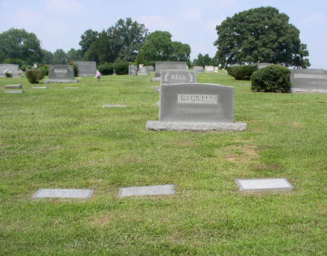
)
)
)
)
)
_FAMILY_CEMETERY)
)
)
)
)