Use the following to search across all the cemeteries listed.
Example: "Smith, Roger" (yes, use the quotes)
- 013 ARRINGTON, JOHN FAMILY
 
Location - corner of Quarter Rd and Hwy 43 in the old Hilliardston Community.
Coordinates: 36d 04m 59.9s N; 77d 56m 07.8s W Click here for Online Maps
- 009 BOSEMAN, W. W. FAMILY
Location - on Griffin School Rd (SR-1418) about 0.3 mile from West Hilliardston Rd (SR-1310).
Coordinates: 36d 05m 30.2s N; 77d 58m 11.1s W Click here for Online Maps
- 006 BUNN, J. H. FAMILY
Location - about 150 feet off the end of Foxden Court near Sportsman Trail.
Coordinates: 35d 59m 20.5s N; 77d 50m 45.0s W Click here for Online Maps
- 015 CULPEPPER, GEORGE WASHINGTON FAMILY
Location - at the end of Cottage Way off Garden Gate Dr off Bethlehem Rd, southwest of Rocky Mount.
Coordinates: 35d 56m 10.2s N; 77d 51m 25.3s W Click here for Online Maps
- 012 F. W. STONE MEMORIAL CEMETERY
Location - 9009 Stone Heritage Rd., Middlesex.
Coordinates: 35d 47m 21.3s N; 78d 09m 05.9s W Click here for Online Maps
- 001 FLOODS CHAPEL FREE WILL BAPTIST CHURCH
Location - church is at the intersection of NC 97 and NC 581. The address is 5149 NC 97 West, Spring Hope, NC.
Coordinates: 35d 51m 57.3s N; 78d 06m 04.3s W Click here for Online Maps
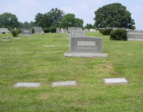
- 021 FOREST HILLS CEMETERY
Location - between E Cedar St and N 1st St, on the north side of Nashville.
Coordinates: 35d 58m 37.8s N; 77d 57m 37.4s W Click here for Online Maps
- 018 HARPER FAMILY
Location - on Taylors Gin Rd, near intersection with Duke Rd, about 2 miles southeast of Castalia.
Coordinates: 36d 03m 51.8s N; 78d 01m 51.2s W Click here for Online Maps
- 019 JONES FAMILY
Location - on the north side of NC 43 (Red Oak Blvd.) northwest of Red Oak.
Coordinates: 36d 03m 54.3s N; 77d 55m 54.2s W Click here for Online Maps
- 003 LEES CHAPEL BAPTIST CHURCH
Location - 14551 Taylors Mill Rd, Middlesex NC.
Coordinates: 35d 46m 39.1s N; 78d 14m 05.6s W Click here for Online Maps
- 002 PEACHTREE BAPTIST CHURCH
Location - at the junction of Highway 581 and SR-1321, approximately 3 miles north of Spring Hope
Coordinates: 35d 59m 43.7s N; 78d 07m 32.6s W Click here for Online Maps
- 004 RICKS, AMOS FAMILY
Location - on the south side of Oak Level Rd (SR-1700) near Old Carriage Rd (SR-1603).
Coordinates: 35d 56m 46.2s N; 77d 54m 02.4s W Click here for Online Maps
- 007 RICKS, DAVID B. FAMILY
Location - about 300 feet off the end of Foxden Court near Sportsman Trail.
Coordinates: 35d 59m 20.7s N; 77d 50m 43.4s W Click here for Online Maps
- 016 ROCKY CROSS HOLINESS CHURCH
Location - 12524 Anderson Road at the intersection with Rocky Cross Rd., Zebulon.
Coordinates: 35d 52m 23.4s N; 78d 13m 24.0s W Click here for Online Maps
- 017 SANDY LEVEL CHURCH
Location - on Stoney Hill Church Rd at the intersection with Bailey Rd, in the old Sandy Level Community.
Coordinates: 35d 48m 29.9s N; 78d 04m 17.9s W Click here for Online Maps
- 010 STRICKLAND, MADISON FAMILY
Location - at the intersection of Hwy 64 and Hwy 231 west of Spring Hope.
Coordinates: 35d 54m 54.0s N; 78d 09m 45.2s W Click here for Online Maps
- 014 TAYLOR FAMILY
Location - on Hwy 58 at Delbridge St, Castalia.
Coordinates: 36d 05m 04.6s N; 78d 03m 41.0s W Click here for Online Maps
- 020 THORNE, JOHN E. FAMILY
Location - in Stoney Creek Township northwest of Rocky Mount, east of Interstate 95, west of NC 48 and north of NC 43.
Coordinates: 36d 01m 16.0s N; 77d 49m 34.4s W Click here for Online Maps
- 008 TISDALE FAMILY
Location - about 300 feet off Grover Rd (SR-1417) about 0.8 mile from Red Rd (SR-1423)..
Coordinates: 36d 04m 35.3s N; 77d 56m 42.2s W Click here for Online Maps
- 011 WOODARD FAMILY
Location - on Frazier Rd about 1 mile west of Hwy 231.
Coordinates: 35d 53m 48.2s N; 78d 10m 47.4s W Click here for Online Maps
- 005 WOODRUFF, JOHN JAMES FAMILY
Location - off Brake Rd (SR-1612) near Woodruff Rd and about 100 feet into a field.
Coordinates: 35d 59m 46.9s N; 77d 50m 28.7s W Click here for Online Maps
Web page updated 20 April 2021
|
|
 |